You are here: Home > Network List > TA - USArray Transportable Network (new EarthScope stations) Stations List
> Station L46A Eue Claire, MI, USA > Earthquake Result Viewer
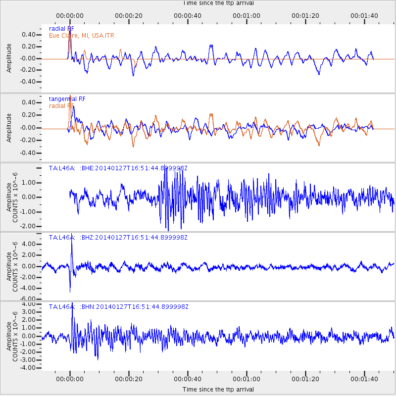
L46A Eue Claire, MI, USA - Earthquake Result Viewer
*The percent match for this event was below the threshold and hence no stack was calculated.
| Earthquake location: |
Southern Bolivia |
| Earthquake latitude/longitude: |
-19.3/-63.9 |
| Earthquake time(UTC): |
2014/01/27 (027) 16:42:37 GMT |
| Earthquake Depth: |
600 km |
| Earthquake Magnitude: |
5.6 MWB |
| Earthquake Catalog/Contributor: |
NEIC PDE/NEIC COMCAT |
|
| Network: |
TA USArray Transportable Network (new EarthScope stations) |
| Station: |
L46A Eue Claire, MI, USA |
| Lat/Lon: |
42.01 N/86.30 W |
| Elevation: |
223 m |
|
| Distance: |
64.4 deg |
| Az: |
341.661 deg |
| Baz: |
156.493 deg |
| Ray Param: |
$rayparam |
*The percent match for this event was below the threshold and hence was not used in the summary stack. |
|
| Radial Match: |
57.785976 % |
| Radial Bump: |
400 |
| Transverse Match: |
65.26617 % |
| Transverse Bump: |
400 |
| SOD ConfigId: |
626651 |
| Insert Time: |
2014-04-20 12:56:08.672 +0000 |
| GWidth: |
2.5 |
| Max Bumps: |
400 |
| Tol: |
0.001 |
|
Signal To Noise
| Channel | StoN | STA | LTA |
| TA:L46A: :BHZ:20140127T16:51:44.899998Z | 3.812263 | 1.4572412E-6 | 3.8225096E-7 |
| TA:L46A: :BHN:20140127T16:51:44.899998Z | 3.686656 | 1.2102535E-6 | 3.2827947E-7 |
| TA:L46A: :BHE:20140127T16:51:44.899998Z | 2.5984216 | 9.894219E-7 | 3.8077803E-7 |
| Arrivals |
| Ps | |
| PpPs | |
| PsPs/PpSs | |


