You are here: Home > Network List > TA - USArray Transportable Network (new EarthScope stations) Stations List
> Station Q53A Leroy, WV, USA > Earthquake Result Viewer
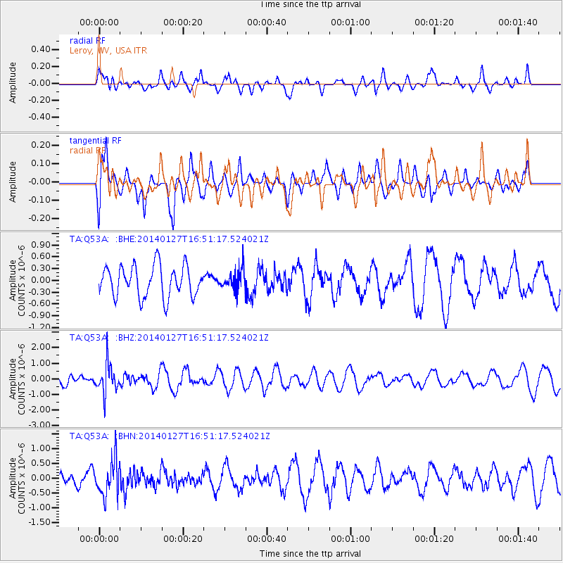
Q53A Leroy, WV, USA - Earthquake Result Viewer
*The percent match for this event was below the threshold and hence no stack was calculated.
| Earthquake location: |
Southern Bolivia |
| Earthquake latitude/longitude: |
-19.3/-63.9 |
| Earthquake time(UTC): |
2014/01/27 (027) 16:42:37 GMT |
| Earthquake Depth: |
600 km |
| Earthquake Magnitude: |
5.6 MWB |
| Earthquake Catalog/Contributor: |
NEIC PDE/NEIC COMCAT |
|
| Network: |
TA USArray Transportable Network (new EarthScope stations) |
| Station: |
Q53A Leroy, WV, USA |
| Lat/Lon: |
38.86 N/81.53 W |
| Elevation: |
310 m |
|
| Distance: |
60.1 deg |
| Az: |
344.195 deg |
| Baz: |
160.758 deg |
| Ray Param: |
$rayparam |
*The percent match for this event was below the threshold and hence was not used in the summary stack. |
|
| Radial Match: |
49.710876 % |
| Radial Bump: |
400 |
| Transverse Match: |
65.32807 % |
| Transverse Bump: |
400 |
| SOD ConfigId: |
626651 |
| Insert Time: |
2014-04-20 12:59:06.674 +0000 |
| GWidth: |
2.5 |
| Max Bumps: |
400 |
| Tol: |
0.001 |
|
Signal To Noise
| Channel | StoN | STA | LTA |
| TA:Q53A: :BHZ:20140127T16:51:17.524021Z | 2.3869505 | 9.037269E-7 | 3.7861153E-7 |
| TA:Q53A: :BHN:20140127T16:51:17.524021Z | 1.6400644 | 6.2509633E-7 | 3.8114135E-7 |
| TA:Q53A: :BHE:20140127T16:51:17.524021Z | 0.67086416 | 2.6435762E-7 | 3.9405538E-7 |
| Arrivals |
| Ps | |
| PpPs | |
| PsPs/PpSs | |


