You are here: Home > Network List > TA - USArray Transportable Network (new EarthScope stations) Stations List
> Station V50A Pikevile, TN, USA > Earthquake Result Viewer
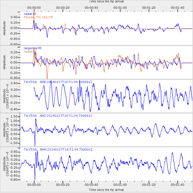
V50A Pikevile, TN, USA - Earthquake Result Viewer
*The percent match for this event was below the threshold and hence no stack was calculated.
| Earthquake location: |
Southern Bolivia |
| Earthquake latitude/longitude: |
-19.3/-63.9 |
| Earthquake time(UTC): |
2014/01/27 (027) 16:42:37 GMT |
| Earthquake Depth: |
600 km |
| Earthquake Magnitude: |
5.6 MWB |
| Earthquake Catalog/Contributor: |
NEIC PDE/NEIC COMCAT |
|
| Network: |
TA USArray Transportable Network (new EarthScope stations) |
| Station: |
V50A Pikevile, TN, USA |
| Lat/Lon: |
35.67 N/85.10 W |
| Elevation: |
287 m |
|
| Distance: |
58.2 deg |
| Az: |
339.749 deg |
| Baz: |
156.321 deg |
| Ray Param: |
$rayparam |
*The percent match for this event was below the threshold and hence was not used in the summary stack. |
|
| Radial Match: |
56.91665 % |
| Radial Bump: |
400 |
| Transverse Match: |
41.559933 % |
| Transverse Bump: |
400 |
| SOD ConfigId: |
626651 |
| Insert Time: |
2014-04-20 13:01:06.231 +0000 |
| GWidth: |
2.5 |
| Max Bumps: |
400 |
| Tol: |
0.001 |
|
Signal To Noise
| Channel | StoN | STA | LTA |
| TA:V50A: :BHZ:20140127T16:51:04.799991Z | 1.6183354 | 5.4685296E-7 | 3.379108E-7 |
| TA:V50A: :BHN:20140127T16:51:04.799991Z | 1.5129809 | 3.0184933E-7 | 1.9950637E-7 |
| TA:V50A: :BHE:20140127T16:51:04.799991Z | 0.859979 | 1.980476E-7 | 2.3029354E-7 |
| Arrivals |
| Ps | |
| PpPs | |
| PsPs/PpSs | |


