You are here: Home > Network List > TA - USArray Transportable Network (new EarthScope stations) Stations List
> Station W59A Clinton, NC, USA > Earthquake Result Viewer
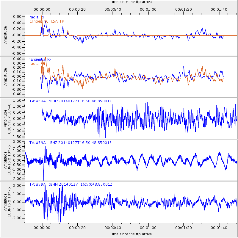
W59A Clinton, NC, USA - Earthquake Result Viewer
*The percent match for this event was below the threshold and hence no stack was calculated.
| Earthquake location: |
Southern Bolivia |
| Earthquake latitude/longitude: |
-19.3/-63.9 |
| Earthquake time(UTC): |
2014/01/27 (027) 16:42:37 GMT |
| Earthquake Depth: |
600 km |
| Earthquake Magnitude: |
5.6 MWB |
| Earthquake Catalog/Contributor: |
NEIC PDE/NEIC COMCAT |
|
| Network: |
TA USArray Transportable Network (new EarthScope stations) |
| Station: |
W59A Clinton, NC, USA |
| Lat/Lon: |
35.17 N/78.44 W |
| Elevation: |
60 m |
|
| Distance: |
55.9 deg |
| Az: |
345.625 deg |
| Baz: |
163.365 deg |
| Ray Param: |
$rayparam |
*The percent match for this event was below the threshold and hence was not used in the summary stack. |
|
| Radial Match: |
59.15959 % |
| Radial Bump: |
400 |
| Transverse Match: |
45.58559 % |
| Transverse Bump: |
400 |
| SOD ConfigId: |
626651 |
| Insert Time: |
2014-04-20 13:01:51.456 +0000 |
| GWidth: |
2.5 |
| Max Bumps: |
400 |
| Tol: |
0.001 |
|
Signal To Noise
| Channel | StoN | STA | LTA |
| TA:W59A: :BHZ:20140127T16:50:48.85001Z | 1.6904578 | 6.557142E-7 | 3.8789148E-7 |
| TA:W59A: :BHN:20140127T16:50:48.85001Z | 3.7377028 | 9.911769E-7 | 2.6518342E-7 |
| TA:W59A: :BHE:20140127T16:50:48.85001Z | 2.0296133 | 5.8568895E-7 | 2.885717E-7 |
| Arrivals |
| Ps | |
| PpPs | |
| PsPs/PpSs | |


