You are here: Home > Network List > US - United States National Seismic Network Stations List
> Station HAWA Hanford, Washington, USA > Earthquake Result Viewer
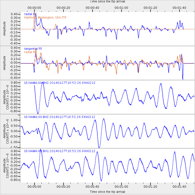
HAWA Hanford, Washington, USA - Earthquake Result Viewer
*The percent match for this event was below the threshold and hence no stack was calculated.
| Earthquake location: |
Southern Bolivia |
| Earthquake latitude/longitude: |
-19.3/-63.9 |
| Earthquake time(UTC): |
2014/01/27 (027) 16:42:37 GMT |
| Earthquake Depth: |
600 km |
| Earthquake Magnitude: |
5.6 MWB |
| Earthquake Catalog/Contributor: |
NEIC PDE/NEIC COMCAT |
|
| Network: |
US United States National Seismic Network |
| Station: |
HAWA Hanford, Washington, USA |
| Lat/Lon: |
46.39 N/119.53 W |
| Elevation: |
364 m |
|
| Distance: |
82.4 deg |
| Az: |
324.811 deg |
| Baz: |
128.133 deg |
| Ray Param: |
$rayparam |
*The percent match for this event was below the threshold and hence was not used in the summary stack. |
|
| Radial Match: |
50.991882 % |
| Radial Bump: |
400 |
| Transverse Match: |
48.45375 % |
| Transverse Bump: |
400 |
| SOD ConfigId: |
626651 |
| Insert Time: |
2014-04-20 13:03:50.942 +0000 |
| GWidth: |
2.5 |
| Max Bumps: |
400 |
| Tol: |
0.001 |
|
Signal To Noise
| Channel | StoN | STA | LTA |
| US:HAWA:00:BHZ:20140127T16:53:26.649021Z | 0.6704008 | 2.3329508E-7 | 3.4799345E-7 |
| US:HAWA:00:BH1:20140127T16:53:26.649021Z | 1.8641454 | 5.087781E-7 | 2.7292836E-7 |
| US:HAWA:00:BH2:20140127T16:53:26.649021Z | 0.2725101 | 1.0382545E-7 | 3.8099668E-7 |
| Arrivals |
| Ps | |
| PpPs | |
| PsPs/PpSs | |


