You are here: Home > Network List > UW - Pacific Northwest Regional Seismic Network Stations List
> Station LCCR Mulino, OR, USA > Earthquake Result Viewer
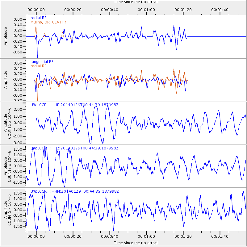
LCCR Mulino, OR, USA - Earthquake Result Viewer
*The percent match for this event was below the threshold and hence no stack was calculated.
| Earthquake location: |
Solomon Islands |
| Earthquake latitude/longitude: |
-9.6/161.2 |
| Earthquake time(UTC): |
2014/01/29 (029) 00:32:28 GMT |
| Earthquake Depth: |
41 km |
| Earthquake Magnitude: |
5.6 MWB, 5.6 MWC |
| Earthquake Catalog/Contributor: |
NEIC PDE/NEIC COMCAT |
|
| Network: |
UW Pacific Northwest Regional Seismic Network |
| Station: |
LCCR Mulino, OR, USA |
| Lat/Lon: |
45.21 N/122.48 W |
| Elevation: |
273 m |
|
| Distance: |
87.2 deg |
| Az: |
43.441 deg |
| Baz: |
253.581 deg |
| Ray Param: |
$rayparam |
*The percent match for this event was below the threshold and hence was not used in the summary stack. |
|
| Radial Match: |
51.59846 % |
| Radial Bump: |
400 |
| Transverse Match: |
54.59497 % |
| Transverse Bump: |
400 |
| SOD ConfigId: |
626651 |
| Insert Time: |
2014-04-20 13:19:23.325 +0000 |
| GWidth: |
2.5 |
| Max Bumps: |
400 |
| Tol: |
0.001 |
|
Signal To Noise
| Channel | StoN | STA | LTA |
| UW:LCCR: :HHZ:20140129T00:44:39.187998Z | 2.5814397 | 1.172065E-6 | 4.540354E-7 |
| UW:LCCR: :HHN:20140129T00:44:39.187998Z | 1.7136086 | 1.1700436E-6 | 6.827951E-7 |
| UW:LCCR: :HHE:20140129T00:44:39.187998Z | 2.444776 | 2.1114108E-6 | 8.636418E-7 |
| Arrivals |
| Ps | |
| PpPs | |
| PsPs/PpSs | |


