You are here: Home > Network List > UW - Pacific Northwest Regional Seismic Network Stations List
> Station LON Longmire (broad-band and DWWSSN) > Earthquake Result Viewer
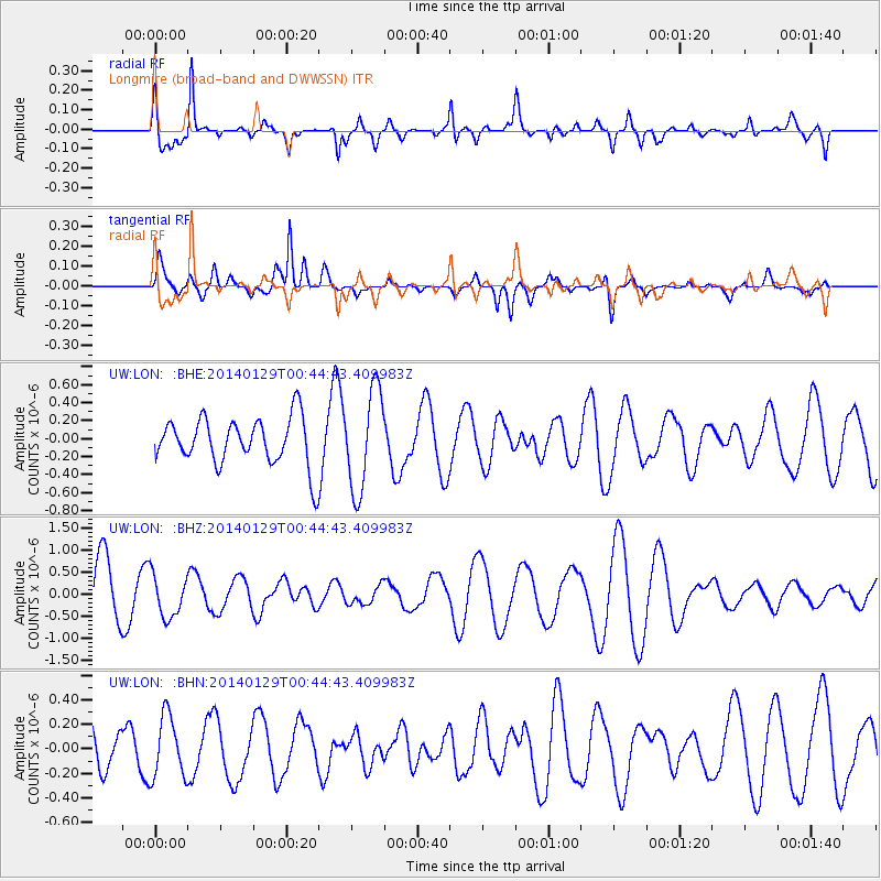
LON Longmire (broad-band and DWWSSN) - Earthquake Result Viewer
*The percent match for this event was below the threshold and hence no stack was calculated.
| Earthquake location: |
Solomon Islands |
| Earthquake latitude/longitude: |
-9.6/161.2 |
| Earthquake time(UTC): |
2014/01/29 (029) 00:32:28 GMT |
| Earthquake Depth: |
41 km |
| Earthquake Magnitude: |
5.6 MWB, 5.6 MWC |
| Earthquake Catalog/Contributor: |
NEIC PDE/NEIC COMCAT |
|
| Network: |
UW Pacific Northwest Regional Seismic Network |
| Station: |
LON Longmire (broad-band and DWWSSN) |
| Lat/Lon: |
46.75 N/121.81 W |
| Elevation: |
850 m |
|
| Distance: |
88.1 deg |
| Az: |
42.087 deg |
| Baz: |
254.005 deg |
| Ray Param: |
$rayparam |
*The percent match for this event was below the threshold and hence was not used in the summary stack. |
|
| Radial Match: |
75.06037 % |
| Radial Bump: |
400 |
| Transverse Match: |
47.47275 % |
| Transverse Bump: |
400 |
| SOD ConfigId: |
626651 |
| Insert Time: |
2014-04-20 13:19:24.835 +0000 |
| GWidth: |
2.5 |
| Max Bumps: |
400 |
| Tol: |
0.001 |
|
Signal To Noise
| Channel | StoN | STA | LTA |
| UW:LON: :BHZ:20140129T00:44:43.409983Z | 0.8967018 | 4.892163E-7 | 5.4557296E-7 |
| UW:LON: :BHN:20140129T00:44:43.409983Z | 0.99630857 | 2.5251245E-7 | 2.5344804E-7 |
| UW:LON: :BHE:20140129T00:44:43.409983Z | 2.1196804 | 5.5540085E-7 | 2.6202105E-7 |
| Arrivals |
| Ps | |
| PpPs | |
| PsPs/PpSs | |


