You are here: Home > Network List > TA - USArray Transportable Network (new EarthScope stations) Stations List
> Station 121A Cookes Peak, Deming, NM, USA > Earthquake Result Viewer
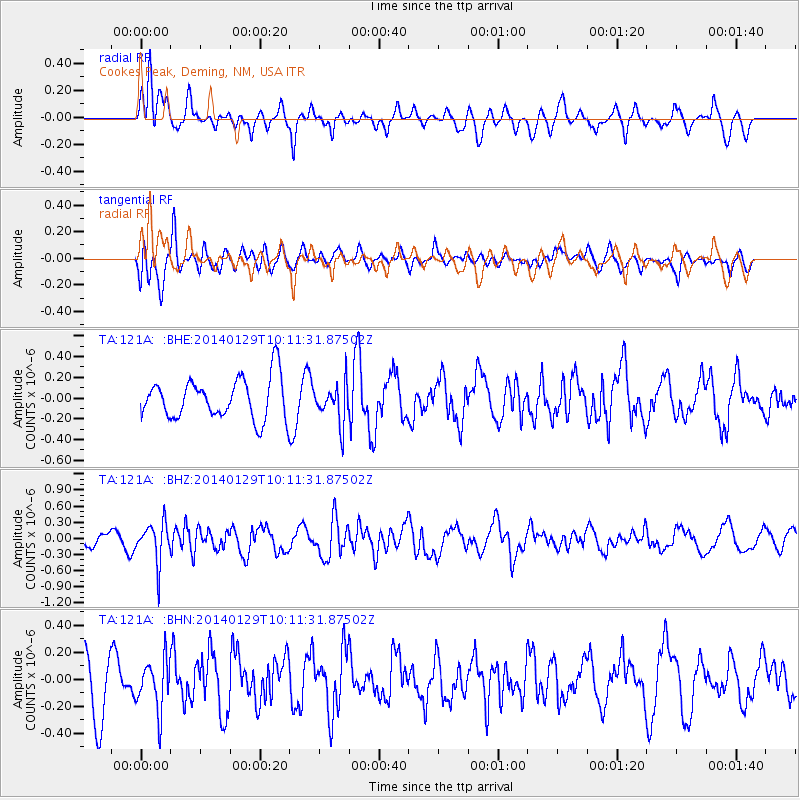
121A Cookes Peak, Deming, NM, USA - Earthquake Result Viewer
*The percent match for this event was below the threshold and hence no stack was calculated.
| Earthquake location: |
Northern Chile |
| Earthquake latitude/longitude: |
-18.5/-69.4 |
| Earthquake time(UTC): |
2014/01/29 (029) 10:01:50 GMT |
| Earthquake Depth: |
120 km |
| Earthquake Magnitude: |
5.6 MWW, 5.6 MWB, 5.7 MWC |
| Earthquake Catalog/Contributor: |
NEIC PDE/NEIC COMCAT |
|
| Network: |
TA USArray Transportable Network (new EarthScope stations) |
| Station: |
121A Cookes Peak, Deming, NM, USA |
| Lat/Lon: |
32.53 N/107.79 W |
| Elevation: |
1652 m |
|
| Distance: |
62.7 deg |
| Az: |
323.786 deg |
| Baz: |
138.419 deg |
| Ray Param: |
$rayparam |
*The percent match for this event was below the threshold and hence was not used in the summary stack. |
|
| Radial Match: |
54.72369 % |
| Radial Bump: |
400 |
| Transverse Match: |
55.765175 % |
| Transverse Bump: |
400 |
| SOD ConfigId: |
626651 |
| Insert Time: |
2014-04-20 13:32:32.260 +0000 |
| GWidth: |
2.5 |
| Max Bumps: |
400 |
| Tol: |
0.001 |
|
Signal To Noise
| Channel | StoN | STA | LTA |
| TA:121A: :BHZ:20140129T10:11:31.87502Z | 2.819154 | 3.6781773E-7 | 1.3047095E-7 |
| TA:121A: :BHN:20140129T10:11:31.87502Z | 1.0440173 | 1.8903172E-7 | 1.8106186E-7 |
| TA:121A: :BHE:20140129T10:11:31.87502Z | 0.974047 | 1.9115092E-7 | 1.9624405E-7 |
| Arrivals |
| Ps | |
| PpPs | |
| PsPs/PpSs | |


