You are here: Home > Network List > TA - USArray Transportable Network (new EarthScope stations) Stations List
> Station G59A Clarenceville, QC, USA > Earthquake Result Viewer
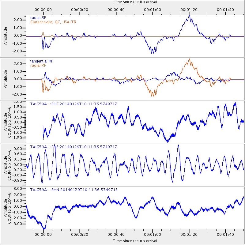
G59A Clarenceville, QC, USA - Earthquake Result Viewer
*The percent match for this event was below the threshold and hence no stack was calculated.
| Earthquake location: |
Northern Chile |
| Earthquake latitude/longitude: |
-18.5/-69.4 |
| Earthquake time(UTC): |
2014/01/29 (029) 10:01:50 GMT |
| Earthquake Depth: |
120 km |
| Earthquake Magnitude: |
5.6 MWW, 5.6 MWB, 5.7 MWC |
| Earthquake Catalog/Contributor: |
NEIC PDE/NEIC COMCAT |
|
| Network: |
TA USArray Transportable Network (new EarthScope stations) |
| Station: |
G59A Clarenceville, QC, USA |
| Lat/Lon: |
45.08 N/73.18 W |
| Elevation: |
36 m |
|
| Distance: |
63.4 deg |
| Az: |
356.983 deg |
| Baz: |
175.958 deg |
| Ray Param: |
$rayparam |
*The percent match for this event was below the threshold and hence was not used in the summary stack. |
|
| Radial Match: |
16.002441 % |
| Radial Bump: |
400 |
| Transverse Match: |
21.61699 % |
| Transverse Bump: |
400 |
| SOD ConfigId: |
626651 |
| Insert Time: |
2014-04-20 13:34:02.806 +0000 |
| GWidth: |
2.5 |
| Max Bumps: |
400 |
| Tol: |
0.001 |
|
Signal To Noise
| Channel | StoN | STA | LTA |
| TA:G59A: :BHZ:20140129T10:11:36.574971Z | 2.0112066 | 6.454663E-7 | 3.2093484E-7 |
| TA:G59A: :BHN:20140129T10:11:36.574971Z | 1.7104526 | 5.0081485E-6 | 2.9279668E-6 |
| TA:G59A: :BHE:20140129T10:11:36.574971Z | 1.8045104 | 1.107716E-6 | 6.138596E-7 |
| Arrivals |
| Ps | |
| PpPs | |
| PsPs/PpSs | |


