You are here: Home > Network List > WI - West Indies IPGP Network Stations List
> Station BIM Morne Bigot, Anses d'Arlets, Martinique > Earthquake Result Viewer
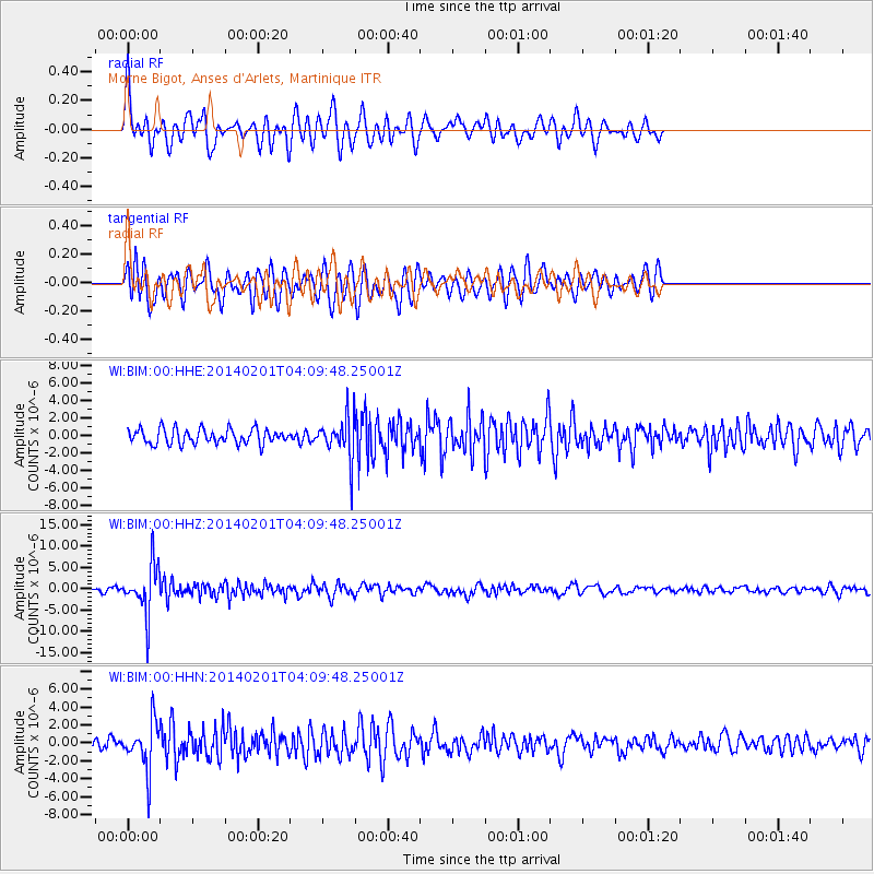
BIM Morne Bigot, Anses d'Arlets, Martinique - Earthquake Result Viewer
*The percent match for this event was below the threshold and hence no stack was calculated.
| Earthquake location: |
South Sandwich Islands Region |
| Earthquake latitude/longitude: |
-56.8/-27.3 |
| Earthquake time(UTC): |
2014/02/01 (032) 03:58:43 GMT |
| Earthquake Depth: |
130 km |
| Earthquake Magnitude: |
6.1 MWW, 6.1 MWC, 6.1 MWB, 6.2 MWC |
| Earthquake Catalog/Contributor: |
NEIC PDE/NEIC COMCAT |
|
| Network: |
WI West Indies IPGP Network |
| Station: |
BIM Morne Bigot, Anses d'Arlets, Martinique |
| Lat/Lon: |
14.52 N/61.07 W |
| Elevation: |
391 m |
|
| Distance: |
76.4 deg |
| Az: |
326.414 deg |
| Baz: |
161.699 deg |
| Ray Param: |
$rayparam |
*The percent match for this event was below the threshold and hence was not used in the summary stack. |
|
| Radial Match: |
67.95428 % |
| Radial Bump: |
400 |
| Transverse Match: |
66.972824 % |
| Transverse Bump: |
400 |
| SOD ConfigId: |
626651 |
| Insert Time: |
2014-04-20 13:49:39.696 +0000 |
| GWidth: |
2.5 |
| Max Bumps: |
400 |
| Tol: |
0.001 |
|
Signal To Noise
| Channel | StoN | STA | LTA |
| WI:BIM:00:HHZ:20140201T04:09:48.25001Z | 12.089202 | 5.681101E-6 | 4.6993185E-7 |
| WI:BIM:00:HHN:20140201T04:09:48.25001Z | 3.4021928 | 2.6037553E-6 | 7.6531677E-7 |
| WI:BIM:00:HHE:20140201T04:09:48.25001Z | 2.6821766 | 2.3178206E-6 | 8.641566E-7 |
| Arrivals |
| Ps | |
| PpPs | |
| PsPs/PpSs | |


