You are here: Home > Network List > BK - Berkeley Digital Seismograph Network Stations List
> Station HUMO Hull Mountain, OR > Earthquake Result Viewer
HUMO Hull Mountain, OR - Earthquake Result Viewer
*The percent match for this event was below the threshold and hence no stack was calculated.
| Earthquake location: |
South Of Kermadec Islands |
| Earthquake latitude/longitude: |
-32.9/-177.9 |
| Earthquake time(UTC): |
2014/02/02 (033) 09:26:37 GMT |
| Earthquake Depth: |
44 km |
| Earthquake Magnitude: |
6.5 MWW, 6.5 MWC, 6.5 MI |
| Earthquake Catalog/Contributor: |
NEIC PDE/NEIC COMCAT |
|
| Network: |
BK Berkeley Digital Seismograph Network |
| Station: |
HUMO Hull Mountain, OR |
| Lat/Lon: |
42.61 N/122.96 W |
| Elevation: |
555 m |
|
| Distance: |
90.4 deg |
| Az: |
37.172 deg |
| Baz: |
223.508 deg |
| Ray Param: |
$rayparam |
*The percent match for this event was below the threshold and hence was not used in the summary stack. |
|
| Radial Match: |
75.1529 % |
| Radial Bump: |
400 |
| Transverse Match: |
54.367294 % |
| Transverse Bump: |
305 |
| SOD ConfigId: |
626651 |
| Insert Time: |
2014-04-20 14:09:30.126 +0000 |
| GWidth: |
2.5 |
| Max Bumps: |
400 |
| Tol: |
0.001 |
|
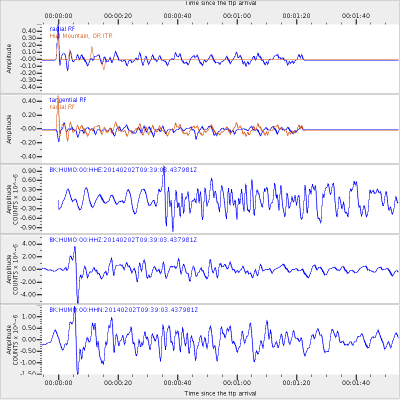
Signal To Noise
| Channel | StoN | STA | LTA |
| BK:HUMO:00:HHZ:20140202T09:39:03.437981Z | 6.061022 | 9.0941114E-7 | 1.5004254E-7 |
| BK:HUMO:00:HHN:20140202T09:39:03.437981Z | 1.4421827 | 4.2360034E-7 | 2.937217E-7 |
| BK:HUMO:00:HHE:20140202T09:39:03.437981Z | 1.1667533 | 1.9902468E-7 | 1.7057994E-7 |
| Arrivals |
| Ps | |
| PpPs | |
| PsPs/PpSs | |


