You are here: Home > Network List > G - GEOSCOPE Stations List
> Station TAOE Taiohae, Marquises islands > Earthquake Result Viewer
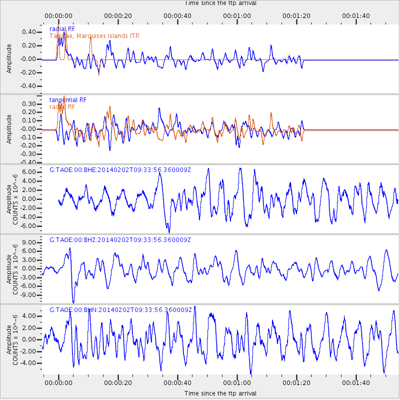
TAOE Taiohae, Marquises islands - Earthquake Result Viewer
*The percent match for this event was below the threshold and hence no stack was calculated.
| Earthquake location: |
South Of Kermadec Islands |
| Earthquake latitude/longitude: |
-32.9/-177.9 |
| Earthquake time(UTC): |
2014/02/02 (033) 09:26:37 GMT |
| Earthquake Depth: |
44 km |
| Earthquake Magnitude: |
6.5 MWW, 6.5 MWC, 6.5 MI |
| Earthquake Catalog/Contributor: |
NEIC PDE/NEIC COMCAT |
|
| Network: |
G GEOSCOPE |
| Station: |
TAOE Taiohae, Marquises islands |
| Lat/Lon: |
8.85 S/140.15 W |
| Elevation: |
800 m |
|
| Distance: |
42.3 deg |
| Az: |
64.077 deg |
| Baz: |
229.958 deg |
| Ray Param: |
$rayparam |
*The percent match for this event was below the threshold and hence was not used in the summary stack. |
|
| Radial Match: |
59.977734 % |
| Radial Bump: |
400 |
| Transverse Match: |
68.1279 % |
| Transverse Bump: |
400 |
| SOD ConfigId: |
626651 |
| Insert Time: |
2014-04-20 14:12:40.228 +0000 |
| GWidth: |
2.5 |
| Max Bumps: |
400 |
| Tol: |
0.001 |
|
Signal To Noise
| Channel | StoN | STA | LTA |
| G:TAOE:00:BHZ:20140202T09:33:56.360009Z | 3.0509853 | 4.00345E-6 | 1.3121826E-6 |
| G:TAOE:00:BHN:20140202T09:33:56.360009Z | 1.7883968 | 2.2122763E-6 | 1.2370165E-6 |
| G:TAOE:00:BHE:20140202T09:33:56.360009Z | 1.9290308 | 2.76611E-6 | 1.4339377E-6 |
| Arrivals |
| Ps | |
| PpPs | |
| PsPs/PpSs | |


