You are here: Home > Network List > TA - USArray Transportable Network (new EarthScope stations) Stations List
> Station 833A Chaparral WMA, Artesia Wells, TX, USA > Earthquake Result Viewer
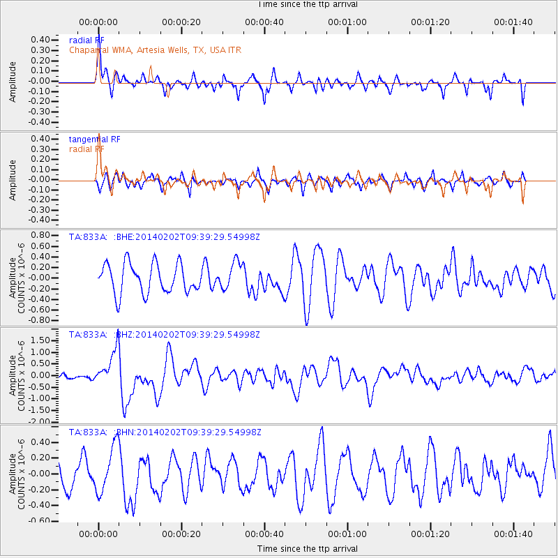
833A Chaparral WMA, Artesia Wells, TX, USA - Earthquake Result Viewer
*The percent match for this event was below the threshold and hence no stack was calculated.
| Earthquake location: |
South Of Kermadec Islands |
| Earthquake latitude/longitude: |
-32.9/-177.9 |
| Earthquake time(UTC): |
2014/02/02 (033) 09:26:37 GMT |
| Earthquake Depth: |
44 km |
| Earthquake Magnitude: |
6.5 MWW, 6.5 MWC, 6.5 MI |
| Earthquake Catalog/Contributor: |
NEIC PDE/NEIC COMCAT |
|
| Network: |
TA USArray Transportable Network (new EarthScope stations) |
| Station: |
833A Chaparral WMA, Artesia Wells, TX, USA |
| Lat/Lon: |
28.32 N/99.39 W |
| Elevation: |
171 m |
|
| Distance: |
96.2 deg |
| Az: |
60.328 deg |
| Baz: |
236.002 deg |
| Ray Param: |
$rayparam |
*The percent match for this event was below the threshold and hence was not used in the summary stack. |
|
| Radial Match: |
62.67978 % |
| Radial Bump: |
393 |
| Transverse Match: |
70.961296 % |
| Transverse Bump: |
400 |
| SOD ConfigId: |
626651 |
| Insert Time: |
2014-04-20 14:18:27.653 +0000 |
| GWidth: |
2.5 |
| Max Bumps: |
400 |
| Tol: |
0.001 |
|
Signal To Noise
| Channel | StoN | STA | LTA |
| TA:833A: :BHZ:20140202T09:39:29.54998Z | 4.7490196 | 8.1201654E-7 | 1.7098613E-7 |
| TA:833A: :BHN:20140202T09:39:29.54998Z | 1.2395548 | 3.0333598E-7 | 2.4471365E-7 |
| TA:833A: :BHE:20140202T09:39:29.54998Z | 0.94808406 | 2.6112772E-7 | 2.7542677E-7 |
| Arrivals |
| Ps | |
| PpPs | |
| PsPs/PpSs | |


