You are here: Home > Network List > TA - USArray Transportable Network (new EarthScope stations) Stations List
> Station G03D McMinnville, OR, USA > Earthquake Result Viewer
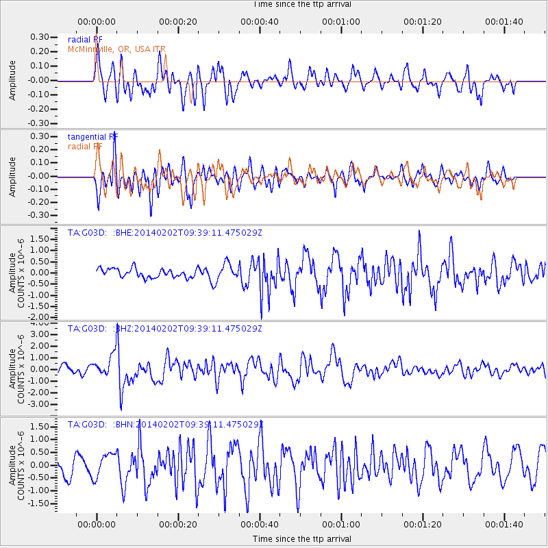
G03D McMinnville, OR, USA - Earthquake Result Viewer
*The percent match for this event was below the threshold and hence no stack was calculated.
| Earthquake location: |
South Of Kermadec Islands |
| Earthquake latitude/longitude: |
-32.9/-177.9 |
| Earthquake time(UTC): |
2014/02/02 (033) 09:26:37 GMT |
| Earthquake Depth: |
44 km |
| Earthquake Magnitude: |
6.5 MWW, 6.5 MWC, 6.5 MI |
| Earthquake Catalog/Contributor: |
NEIC PDE/NEIC COMCAT |
|
| Network: |
TA USArray Transportable Network (new EarthScope stations) |
| Station: |
G03D McMinnville, OR, USA |
| Lat/Lon: |
45.21 N/123.26 W |
| Elevation: |
222 m |
|
| Distance: |
92.2 deg |
| Az: |
35.221 deg |
| Baz: |
223.34 deg |
| Ray Param: |
$rayparam |
*The percent match for this event was below the threshold and hence was not used in the summary stack. |
|
| Radial Match: |
62.82523 % |
| Radial Bump: |
400 |
| Transverse Match: |
67.016685 % |
| Transverse Bump: |
400 |
| SOD ConfigId: |
626651 |
| Insert Time: |
2014-04-20 14:18:58.196 +0000 |
| GWidth: |
2.5 |
| Max Bumps: |
400 |
| Tol: |
0.001 |
|
Signal To Noise
| Channel | StoN | STA | LTA |
| TA:G03D: :BHZ:20140202T09:39:11.475029Z | 2.5047896 | 9.747893E-7 | 3.891701E-7 |
| TA:G03D: :BHN:20140202T09:39:11.475029Z | 1.2452667 | 4.7753986E-7 | 3.83484E-7 |
| TA:G03D: :BHE:20140202T09:39:11.475029Z | 1.9753684 | 3.8078443E-7 | 1.9276628E-7 |
| Arrivals |
| Ps | |
| PpPs | |
| PsPs/PpSs | |


