You are here: Home > Network List > TA - USArray Transportable Network (new EarthScope stations) Stations List
> Station G05D Wamic, OR, USA > Earthquake Result Viewer
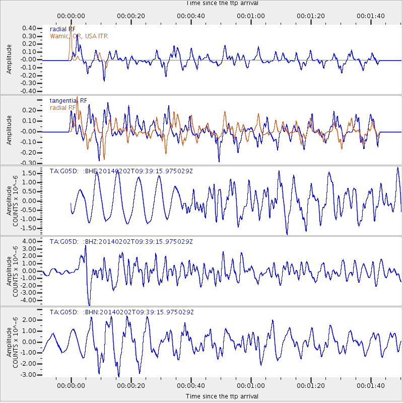
G05D Wamic, OR, USA - Earthquake Result Viewer
*The percent match for this event was below the threshold and hence no stack was calculated.
| Earthquake location: |
South Of Kermadec Islands |
| Earthquake latitude/longitude: |
-32.9/-177.9 |
| Earthquake time(UTC): |
2014/02/02 (033) 09:26:37 GMT |
| Earthquake Depth: |
44 km |
| Earthquake Magnitude: |
6.5 MWW, 6.5 MWC, 6.5 MI |
| Earthquake Catalog/Contributor: |
NEIC PDE/NEIC COMCAT |
|
| Network: |
TA USArray Transportable Network (new EarthScope stations) |
| Station: |
G05D Wamic, OR, USA |
| Lat/Lon: |
45.24 N/121.32 W |
| Elevation: |
592 m |
|
| Distance: |
93.2 deg |
| Az: |
36.19 deg |
| Baz: |
224.673 deg |
| Ray Param: |
$rayparam |
*The percent match for this event was below the threshold and hence was not used in the summary stack. |
|
| Radial Match: |
48.726414 % |
| Radial Bump: |
297 |
| Transverse Match: |
67.66206 % |
| Transverse Bump: |
355 |
| SOD ConfigId: |
626651 |
| Insert Time: |
2014-04-20 14:18:59.949 +0000 |
| GWidth: |
2.5 |
| Max Bumps: |
400 |
| Tol: |
0.001 |
|
Signal To Noise
| Channel | StoN | STA | LTA |
| TA:G05D: :BHZ:20140202T09:39:15.975029Z | 4.8344 | 1.3266185E-6 | 2.7441223E-7 |
| TA:G05D: :BHN:20140202T09:39:15.975029Z | 1.4169186 | 9.104666E-7 | 6.42568E-7 |
| TA:G05D: :BHE:20140202T09:39:15.975029Z | 0.9414266 | 8.034283E-7 | 8.5341577E-7 |
| Arrivals |
| Ps | |
| PpPs | |
| PsPs/PpSs | |


