You are here: Home > Network List > TA - USArray Transportable Network (new EarthScope stations) Stations List
> Station T25A Trinidad, CO, USA > Earthquake Result Viewer
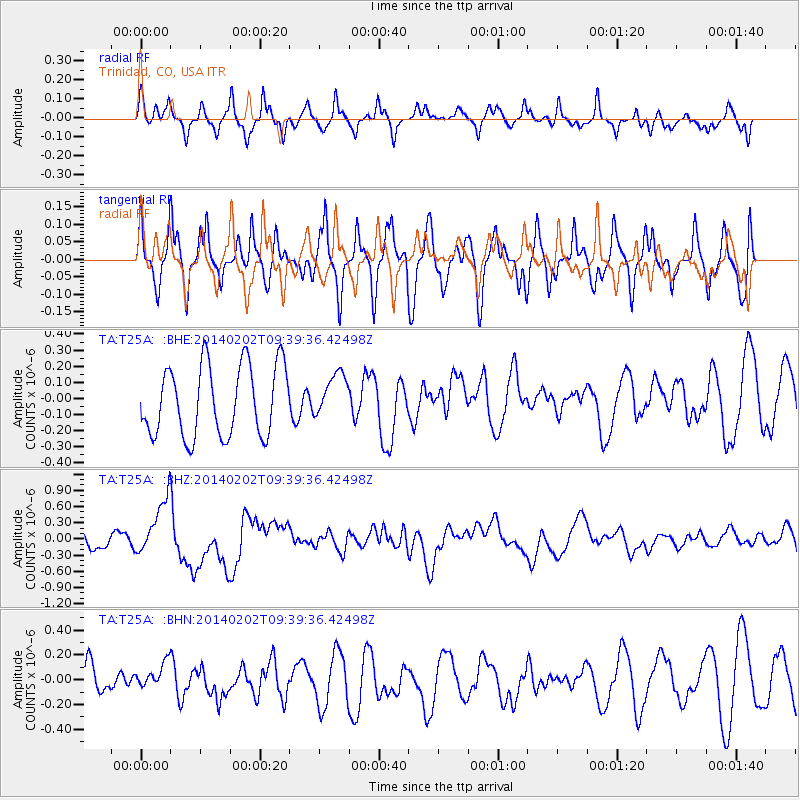
T25A Trinidad, CO, USA - Earthquake Result Viewer
*The percent match for this event was below the threshold and hence no stack was calculated.
| Earthquake location: |
South Of Kermadec Islands |
| Earthquake latitude/longitude: |
-32.9/-177.9 |
| Earthquake time(UTC): |
2014/02/02 (033) 09:26:37 GMT |
| Earthquake Depth: |
44 km |
| Earthquake Magnitude: |
6.5 MWW, 6.5 MWC, 6.5 MI |
| Earthquake Catalog/Contributor: |
NEIC PDE/NEIC COMCAT |
|
| Network: |
TA USArray Transportable Network (new EarthScope stations) |
| Station: |
T25A Trinidad, CO, USA |
| Lat/Lon: |
37.14 N/104.41 W |
| Elevation: |
2017 m |
|
| Distance: |
97.7 deg |
| Az: |
50.628 deg |
| Baz: |
234.465 deg |
| Ray Param: |
$rayparam |
*The percent match for this event was below the threshold and hence was not used in the summary stack. |
|
| Radial Match: |
66.6936 % |
| Radial Bump: |
359 |
| Transverse Match: |
64.51192 % |
| Transverse Bump: |
400 |
| SOD ConfigId: |
626651 |
| Insert Time: |
2014-04-20 14:19:54.600 +0000 |
| GWidth: |
2.5 |
| Max Bumps: |
400 |
| Tol: |
0.001 |
|
Signal To Noise
| Channel | StoN | STA | LTA |
| TA:T25A: :BHZ:20140202T09:39:36.42498Z | 3.8306983 | 5.233733E-7 | 1.3662608E-7 |
| TA:T25A: :BHN:20140202T09:39:36.42498Z | 0.80188245 | 1.11767726E-7 | 1.3938168E-7 |
| TA:T25A: :BHE:20140202T09:39:36.42498Z | 0.62439305 | 1.365779E-7 | 2.1873707E-7 |
| Arrivals |
| Ps | |
| PpPs | |
| PsPs/PpSs | |


