You are here: Home > Network List > US - United States National Seismic Network Stations List
> Station AMTX Amarillo, Texas, USA > Earthquake Result Viewer
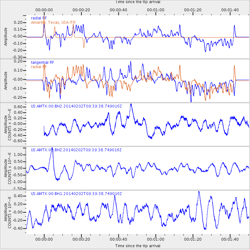
AMTX Amarillo, Texas, USA - Earthquake Result Viewer
*The percent match for this event was below the threshold and hence no stack was calculated.
| Earthquake location: |
South Of Kermadec Islands |
| Earthquake latitude/longitude: |
-32.9/-177.9 |
| Earthquake time(UTC): |
2014/02/02 (033) 09:26:37 GMT |
| Earthquake Depth: |
44 km |
| Earthquake Magnitude: |
6.5 MWW, 6.5 MWC, 6.5 MI |
| Earthquake Catalog/Contributor: |
NEIC PDE/NEIC COMCAT |
|
| Network: |
US United States National Seismic Network |
| Station: |
AMTX Amarillo, Texas, USA |
| Lat/Lon: |
34.53 N/101.41 W |
| Elevation: |
1010 m |
|
| Distance: |
98.2 deg |
| Az: |
54.193 deg |
| Baz: |
235.722 deg |
| Ray Param: |
$rayparam |
*The percent match for this event was below the threshold and hence was not used in the summary stack. |
|
| Radial Match: |
58.167343 % |
| Radial Bump: |
400 |
| Transverse Match: |
42.040672 % |
| Transverse Bump: |
400 |
| SOD ConfigId: |
626651 |
| Insert Time: |
2014-04-20 14:20:29.539 +0000 |
| GWidth: |
2.5 |
| Max Bumps: |
400 |
| Tol: |
0.001 |
|
Signal To Noise
| Channel | StoN | STA | LTA |
| US:AMTX:00:BHZ:20140202T09:39:38.749016Z | 3.864747 | 6.9099525E-7 | 1.7879442E-7 |
| US:AMTX:00:BH1:20140202T09:39:38.749016Z | 0.5189993 | 1.4436715E-7 | 2.7816446E-7 |
| US:AMTX:00:BH2:20140202T09:39:38.749016Z | 1.5925103 | 2.3896197E-7 | 1.5005364E-7 |
| Arrivals |
| Ps | |
| PpPs | |
| PsPs/PpSs | |


