You are here: Home > Network List > US - United States National Seismic Network Stations List
> Station HAWA Hanford, Washington, USA > Earthquake Result Viewer
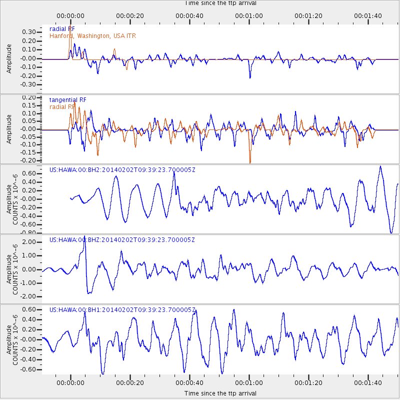
HAWA Hanford, Washington, USA - Earthquake Result Viewer
*The percent match for this event was below the threshold and hence no stack was calculated.
| Earthquake location: |
South Of Kermadec Islands |
| Earthquake latitude/longitude: |
-32.9/-177.9 |
| Earthquake time(UTC): |
2014/02/02 (033) 09:26:37 GMT |
| Earthquake Depth: |
44 km |
| Earthquake Magnitude: |
6.5 MWW, 6.5 MWC, 6.5 MI |
| Earthquake Catalog/Contributor: |
NEIC PDE/NEIC COMCAT |
|
| Network: |
US United States National Seismic Network |
| Station: |
HAWA Hanford, Washington, USA |
| Lat/Lon: |
46.39 N/119.53 W |
| Elevation: |
364 m |
|
| Distance: |
94.9 deg |
| Az: |
36.25 deg |
| Baz: |
225.944 deg |
| Ray Param: |
$rayparam |
*The percent match for this event was below the threshold and hence was not used in the summary stack. |
|
| Radial Match: |
55.748234 % |
| Radial Bump: |
315 |
| Transverse Match: |
80.69946 % |
| Transverse Bump: |
400 |
| SOD ConfigId: |
626651 |
| Insert Time: |
2014-04-20 14:20:39.650 +0000 |
| GWidth: |
2.5 |
| Max Bumps: |
400 |
| Tol: |
0.001 |
|
Signal To Noise
| Channel | StoN | STA | LTA |
| US:HAWA:00:BHZ:20140202T09:39:23.700005Z | 2.907008 | 9.5288834E-7 | 3.2779005E-7 |
| US:HAWA:00:BH1:20140202T09:39:23.700005Z | 1.1781491 | 2.2317711E-7 | 1.894303E-7 |
| US:HAWA:00:BH2:20140202T09:39:23.700005Z | 1.1831594 | 3.0185763E-7 | 2.5512844E-7 |
| Arrivals |
| Ps | |
| PpPs | |
| PsPs/PpSs | |


