You are here: Home > Network List > US - United States National Seismic Network Stations List
> Station MSO Missoula, Montana, USA > Earthquake Result Viewer
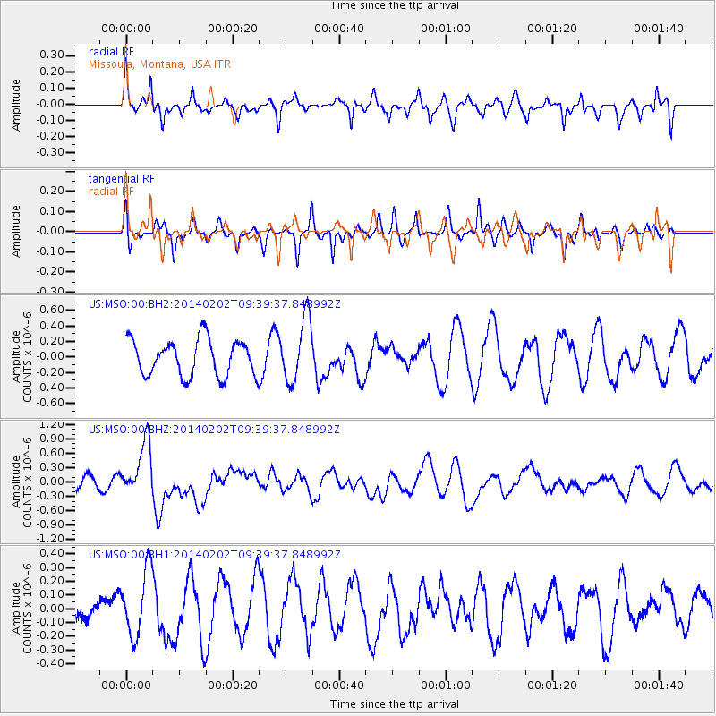
MSO Missoula, Montana, USA - Earthquake Result Viewer
*The percent match for this event was below the threshold and hence no stack was calculated.
| Earthquake location: |
South Of Kermadec Islands |
| Earthquake latitude/longitude: |
-32.9/-177.9 |
| Earthquake time(UTC): |
2014/02/02 (033) 09:26:37 GMT |
| Earthquake Depth: |
44 km |
| Earthquake Magnitude: |
6.5 MWW, 6.5 MWC, 6.5 MI |
| Earthquake Catalog/Contributor: |
NEIC PDE/NEIC COMCAT |
|
| Network: |
US United States National Seismic Network |
| Station: |
MSO Missoula, Montana, USA |
| Lat/Lon: |
46.83 N/113.94 W |
| Elevation: |
1264 m |
|
| Distance: |
98.0 deg |
| Az: |
38.528 deg |
| Baz: |
229.741 deg |
| Ray Param: |
$rayparam |
*The percent match for this event was below the threshold and hence was not used in the summary stack. |
|
| Radial Match: |
39.682644 % |
| Radial Bump: |
305 |
| Transverse Match: |
56.99588 % |
| Transverse Bump: |
258 |
| SOD ConfigId: |
626651 |
| Insert Time: |
2014-04-20 14:20:48.900 +0000 |
| GWidth: |
2.5 |
| Max Bumps: |
400 |
| Tol: |
0.001 |
|
Signal To Noise
| Channel | StoN | STA | LTA |
| US:MSO:00:BHZ:20140202T09:39:37.848992Z | 2.1039565 | 5.7050147E-7 | 2.711565E-7 |
| US:MSO:00:BH1:20140202T09:39:37.848992Z | 2.9068682 | 2.417872E-7 | 8.31779E-8 |
| US:MSO:00:BH2:20140202T09:39:37.848992Z | 1.7750777 | 4.125021E-7 | 2.3238537E-7 |
| Arrivals |
| Ps | |
| PpPs | |
| PsPs/PpSs | |


