You are here: Home > Network List > UU - University of Utah Regional Network Stations List
> Station KNB Kanab, UT, USA > Earthquake Result Viewer
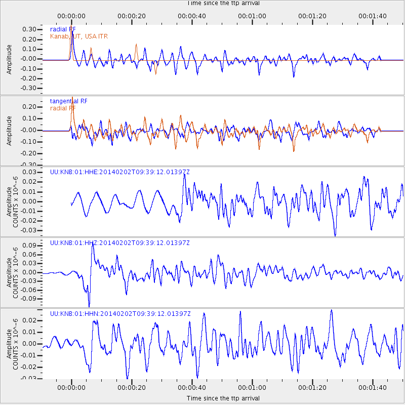
KNB Kanab, UT, USA - Earthquake Result Viewer
*The percent match for this event was below the threshold and hence no stack was calculated.
| Earthquake location: |
South Of Kermadec Islands |
| Earthquake latitude/longitude: |
-32.9/-177.9 |
| Earthquake time(UTC): |
2014/02/02 (033) 09:26:37 GMT |
| Earthquake Depth: |
44 km |
| Earthquake Magnitude: |
6.5 MWW, 6.5 MWC, 6.5 MI |
| Earthquake Catalog/Contributor: |
NEIC PDE/NEIC COMCAT |
|
| Network: |
UU University of Utah Regional Network |
| Station: |
KNB Kanab, UT, USA |
| Lat/Lon: |
37.02 N/112.82 W |
| Elevation: |
1715 m |
|
| Distance: |
92.3 deg |
| Az: |
46.581 deg |
| Baz: |
229.762 deg |
| Ray Param: |
$rayparam |
*The percent match for this event was below the threshold and hence was not used in the summary stack. |
|
| Radial Match: |
76.5455 % |
| Radial Bump: |
400 |
| Transverse Match: |
72.21974 % |
| Transverse Bump: |
400 |
| SOD ConfigId: |
626651 |
| Insert Time: |
2014-04-20 14:21:30.261 +0000 |
| GWidth: |
2.5 |
| Max Bumps: |
400 |
| Tol: |
0.001 |
|
Signal To Noise
| Channel | StoN | STA | LTA |
| UU:KNB:01:HHZ:20140202T09:39:12.01397Z | 6.315632 | 2.4254101E-8 | 3.8403285E-9 |
| UU:KNB:01:HHN:20140202T09:39:12.01397Z | 1.0666825 | 4.48254E-9 | 4.202319E-9 |
| UU:KNB:01:HHE:20140202T09:39:12.01397Z | 1.1366388 | 7.68639E-9 | 6.7623858E-9 |
| Arrivals |
| Ps | |
| PpPs | |
| PsPs/PpSs | |


