You are here: Home > Network List > TA - USArray Transportable Network (new EarthScope stations) Stations List
> Station U51A La Follette, TN, USA > Earthquake Result Viewer
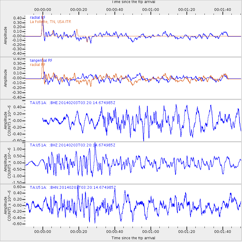
U51A La Follette, TN, USA - Earthquake Result Viewer
*The percent match for this event was below the threshold and hence no stack was calculated.
| Earthquake location: |
Greece |
| Earthquake latitude/longitude: |
38.3/20.4 |
| Earthquake time(UTC): |
2014/02/03 (034) 03:08:46 GMT |
| Earthquake Depth: |
5.0 km |
| Earthquake Magnitude: |
6.0 MWW, 6.0 MWB, 6.1 MWC |
| Earthquake Catalog/Contributor: |
NEIC PDE/NEIC COMCAT |
|
| Network: |
TA USArray Transportable Network (new EarthScope stations) |
| Station: |
U51A La Follette, TN, USA |
| Lat/Lon: |
36.38 N/84.02 W |
| Elevation: |
472 m |
|
| Distance: |
78.1 deg |
| Az: |
306.985 deg |
| Baz: |
51.184 deg |
| Ray Param: |
$rayparam |
*The percent match for this event was below the threshold and hence was not used in the summary stack. |
|
| Radial Match: |
72.993385 % |
| Radial Bump: |
400 |
| Transverse Match: |
45.569958 % |
| Transverse Bump: |
400 |
| SOD ConfigId: |
626651 |
| Insert Time: |
2014-04-20 14:50:16.536 +0000 |
| GWidth: |
2.5 |
| Max Bumps: |
400 |
| Tol: |
0.001 |
|
Signal To Noise
| Channel | StoN | STA | LTA |
| TA:U51A: :BHZ:20140203T03:20:14.674985Z | 2.9113007 | 3.07142E-7 | 1.0549992E-7 |
| TA:U51A: :BHN:20140203T03:20:14.674985Z | 2.159239 | 1.559658E-7 | 7.223183E-8 |
| TA:U51A: :BHE:20140203T03:20:14.674985Z | 1.4356493 | 1.7416328E-7 | 1.2131325E-7 |
| Arrivals |
| Ps | |
| PpPs | |
| PsPs/PpSs | |


