You are here: Home > Network List > US - United States National Seismic Network Stations List
> Station LAO LASA Array, Montana, USA > Earthquake Result Viewer
LAO LASA Array, Montana, USA - Earthquake Result Viewer
*The percent match for this event was below the threshold and hence no stack was calculated.
| Earthquake location: |
Greece |
| Earthquake latitude/longitude: |
38.3/20.4 |
| Earthquake time(UTC): |
2014/02/03 (034) 03:08:46 GMT |
| Earthquake Depth: |
5.0 km |
| Earthquake Magnitude: |
6.0 MWW, 6.0 MWB, 6.1 MWC |
| Earthquake Catalog/Contributor: |
NEIC PDE/NEIC COMCAT |
|
| Network: |
US United States National Seismic Network |
| Station: |
LAO LASA Array, Montana, USA |
| Lat/Lon: |
46.69 N/106.22 W |
| Elevation: |
902 m |
|
| Distance: |
82.9 deg |
| Az: |
326.16 deg |
| Baz: |
39.553 deg |
| Ray Param: |
$rayparam |
*The percent match for this event was below the threshold and hence was not used in the summary stack. |
|
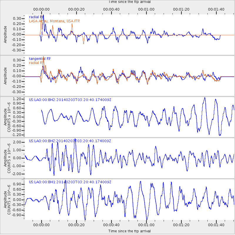
| Radial Match: |
53.885128 % |
| Radial Bump: |
371 |
| Transverse Match: |
57.87296 % |
| Transverse Bump: |
400 |
| SOD ConfigId: |
626651 |
| Insert Time: |
2014-04-20 14:52:51.983 +0000 |
| GWidth: |
2.5 |
| Max Bumps: |
400 |
| Tol: |
0.001 |
|
Signal To Noise
| Channel | StoN | STA | LTA |
| US:LAO:00:BHZ:20140203T03:20:40.174009Z | 2.3772333 | 4.895577E-7 | 2.0593592E-7 |
| US:LAO:00:BH1:20140203T03:20:40.174009Z | 0.6105893 | 2.2217573E-7 | 3.6387095E-7 |
| US:LAO:00:BH2:20140203T03:20:40.174009Z | 1.5432966 | 3.9309123E-7 | 2.547088E-7 |
| Arrivals |
| Ps | |
| PpPs | |
| PsPs/PpSs | |


