You are here: Home > Network List > II - Global Seismograph Network (GSN - IRIS/IDA) Stations List
> Station WRAB Tennant Creek, NT, Australia > Earthquake Result Viewer
WRAB Tennant Creek, NT, Australia - Earthquake Result Viewer
*The percent match for this event was below the threshold and hence no stack was calculated.
| Earthquake location: |
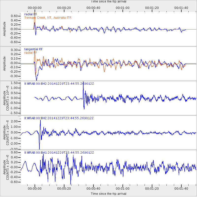
Fiji Islands Region |
| Earthquake latitude/longitude: |
-20.7/-177.6 |
| Earthquake time(UTC): |
2014/12/29 (363) 23:37:56 GMT |
| Earthquake Depth: |
495 km |
| Earthquake Magnitude: |
5.3 MW, 5.1 mb, 5.0 mB |
| Earthquake Catalog/Contributor: |
ISC/ISC |
|
| Network: |
II Global Seismograph Network (GSN - IRIS/IDA) |
| Station: |
WRAB Tennant Creek, NT, Australia |
| Lat/Lon: |
19.93 S/134.36 E |
| Elevation: |
366 m |
|
| Distance: |
44.9 deg |
| Az: |
262.166 deg |
| Baz: |
99.656 deg |
| Ray Param: |
$rayparam |
*The percent match for this event was below the threshold and hence was not used in the summary stack. |
|
| Radial Match: |
68.788246 % |
| Radial Bump: |
400 |
| Transverse Match: |
59.054504 % |
| Transverse Bump: |
400 |
| SOD ConfigId: |
3390531 |
| Insert Time: |
2019-04-15 20:41:16.919 +0000 |
| GWidth: |
2.5 |
| Max Bumps: |
400 |
| Tol: |
0.001 |
|
Signal To Noise
| Channel | StoN | STA | LTA |
| II:WRAB:00:BHZ:20141229T23:44:55.269012Z | 4.6412377 | 8.761994E-7 | 1.8878572E-7 |
| II:WRAB:00:BH1:20141229T23:44:55.269012Z | 1.1872824 | 1.6595597E-7 | 1.39778E-7 |
| II:WRAB:00:BH2:20141229T23:44:55.269012Z | 4.028343 | 4.5443267E-7 | 1.1280883E-7 |
| Arrivals |
| Ps | |
| PpPs | |
| PsPs/PpSs | |


