You are here: Home > Network List > UW - Pacific Northwest Regional Seismic Network Stations List
> Station MRBL Marblemount, WA, USA > Earthquake Result Viewer
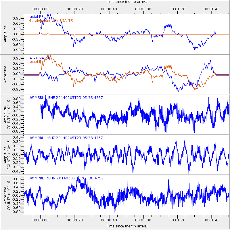
MRBL Marblemount, WA, USA - Earthquake Result Viewer
*The percent match for this event was below the threshold and hence no stack was calculated.
| Earthquake location: |
Vanuatu Islands |
| Earthquake latitude/longitude: |
-20.4/169.3 |
| Earthquake time(UTC): |
2014/02/05 (036) 22:53:05 GMT |
| Earthquake Depth: |
48 km |
| Earthquake Magnitude: |
5.5 MWB |
| Earthquake Catalog/Contributor: |
NEIC PDE/NEIC COMCAT |
|
| Network: |
UW Pacific Northwest Regional Seismic Network |
| Station: |
MRBL Marblemount, WA, USA |
| Lat/Lon: |
48.52 N/121.48 W |
| Elevation: |
75 m |
|
| Distance: |
92.2 deg |
| Az: |
38.479 deg |
| Baz: |
241.39 deg |
| Ray Param: |
$rayparam |
*The percent match for this event was below the threshold and hence was not used in the summary stack. |
|
| Radial Match: |
55.66761 % |
| Radial Bump: |
400 |
| Transverse Match: |
46.750027 % |
| Transverse Bump: |
400 |
| SOD ConfigId: |
626651 |
| Insert Time: |
2014-04-20 15:32:50.654 +0000 |
| GWidth: |
2.5 |
| Max Bumps: |
400 |
| Tol: |
0.001 |
|
Signal To Noise
| Channel | StoN | STA | LTA |
| UW:MRBL: :BHZ:20140205T23:05:38.475Z | 0.5674538 | 7.332435E-8 | 1.2921642E-7 |
| UW:MRBL: :BHN:20140205T23:05:38.475Z | 1.48095 | 2.9940287E-7 | 2.0216946E-7 |
| UW:MRBL: :BHE:20140205T23:05:38.475Z | 1.7437813 | 4.4808544E-7 | 2.5696195E-7 |
| Arrivals |
| Ps | |
| PpPs | |
| PsPs/PpSs | |


