You are here: Home > Network List > US - United States National Seismic Network Stations List
> Station MSO Missoula, Montana, USA > Earthquake Result Viewer
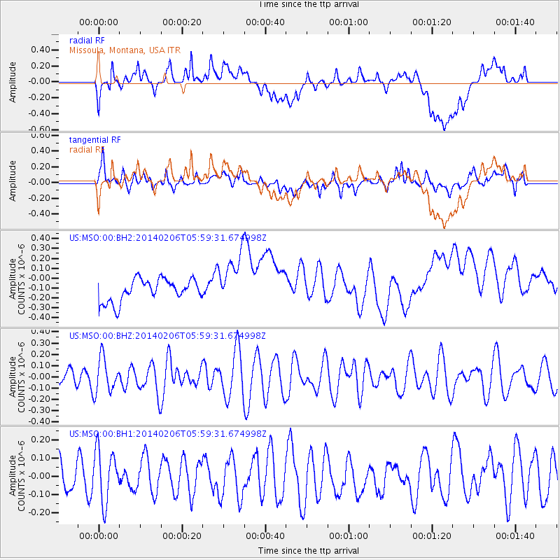
MSO Missoula, Montana, USA - Earthquake Result Viewer
*The percent match for this event was below the threshold and hence no stack was calculated.
| Earthquake location: |
Santa Cruz Islands |
| Earthquake latitude/longitude: |
-11.5/166.4 |
| Earthquake time(UTC): |
2014/02/06 (037) 05:47:02 GMT |
| Earthquake Depth: |
50 km |
| Earthquake Magnitude: |
5.5 MWB |
| Earthquake Catalog/Contributor: |
NEIC PDE/NEIC COMCAT |
|
| Network: |
US United States National Seismic Network |
| Station: |
MSO Missoula, Montana, USA |
| Lat/Lon: |
46.83 N/113.94 W |
| Elevation: |
1264 m |
|
| Distance: |
91.4 deg |
| Az: |
42.505 deg |
| Baz: |
254.658 deg |
| Ray Param: |
$rayparam |
*The percent match for this event was below the threshold and hence was not used in the summary stack. |
|
| Radial Match: |
39.070225 % |
| Radial Bump: |
400 |
| Transverse Match: |
54.93393 % |
| Transverse Bump: |
400 |
| SOD ConfigId: |
626651 |
| Insert Time: |
2014-04-20 15:44:57.556 +0000 |
| GWidth: |
2.5 |
| Max Bumps: |
400 |
| Tol: |
0.001 |
|
Signal To Noise
| Channel | StoN | STA | LTA |
| US:MSO:00:BHZ:20140206T05:59:31.674998Z | 1.4862416 | 1.5150486E-7 | 1.01938255E-7 |
| US:MSO:00:BH1:20140206T05:59:31.674998Z | 1.1232401 | 1.4626293E-7 | 1.3021518E-7 |
| US:MSO:00:BH2:20140206T05:59:31.674998Z | 2.3891895 | 2.709559E-7 | 1.1340913E-7 |
| Arrivals |
| Ps | |
| PpPs | |
| PsPs/PpSs | |


