You are here: Home > Network List > US - United States National Seismic Network Stations List
> Station HAWA Hanford, Washington, USA > Earthquake Result Viewer
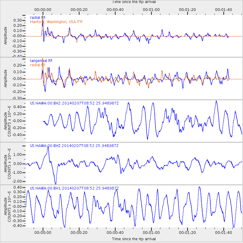
HAWA Hanford, Washington, USA - Earthquake Result Viewer
*The percent match for this event was below the threshold and hence no stack was calculated.
| Earthquake location: |
Vanuatu Islands |
| Earthquake latitude/longitude: |
-15.1/167.4 |
| Earthquake time(UTC): |
2014/02/07 (038) 08:40:13 GMT |
| Earthquake Depth: |
122 km |
| Earthquake Magnitude: |
6.5 MWW, 6.5 MWC, 6.5 MWB, 6.5 MI |
| Earthquake Catalog/Contributor: |
NEIC PDE/NEIC COMCAT |
|
| Network: |
US United States National Seismic Network |
| Station: |
HAWA Hanford, Washington, USA |
| Lat/Lon: |
46.39 N/119.53 W |
| Elevation: |
364 m |
|
| Distance: |
89.5 deg |
| Az: |
41.472 deg |
| Baz: |
247.568 deg |
| Ray Param: |
$rayparam |
*The percent match for this event was below the threshold and hence was not used in the summary stack. |
|
| Radial Match: |
72.27347 % |
| Radial Bump: |
400 |
| Transverse Match: |
61.8647 % |
| Transverse Bump: |
400 |
| SOD ConfigId: |
626651 |
| Insert Time: |
2014-04-20 16:05:18.252 +0000 |
| GWidth: |
2.5 |
| Max Bumps: |
400 |
| Tol: |
0.001 |
|
Signal To Noise
| Channel | StoN | STA | LTA |
| US:HAWA:00:BHZ:20140207T08:52:25.948987Z | 4.823332 | 9.3072305E-7 | 1.9296267E-7 |
| US:HAWA:00:BH1:20140207T08:52:25.948987Z | 0.91086483 | 2.044178E-7 | 2.2442167E-7 |
| US:HAWA:00:BH2:20140207T08:52:25.948987Z | 1.4478242 | 2.325405E-7 | 1.6061377E-7 |
| Arrivals |
| Ps | |
| PpPs | |
| PsPs/PpSs | |


