You are here: Home > Network List > US - United States National Seismic Network Stations List
> Station MSO Missoula, Montana, USA > Earthquake Result Viewer
MSO Missoula, Montana, USA - Earthquake Result Viewer
*The percent match for this event was below the threshold and hence no stack was calculated.
| Earthquake location: |
Vanuatu Islands |
| Earthquake latitude/longitude: |
-15.1/167.4 |
| Earthquake time(UTC): |
2014/02/07 (038) 08:40:13 GMT |
| Earthquake Depth: |
122 km |
| Earthquake Magnitude: |
6.5 MWW, 6.5 MWC, 6.5 MWB, 6.5 MI |
| Earthquake Catalog/Contributor: |
NEIC PDE/NEIC COMCAT |
|
| Network: |
US United States National Seismic Network |
| Station: |
MSO Missoula, Montana, USA |
| Lat/Lon: |
46.83 N/113.94 W |
| Elevation: |
1264 m |
|
| Distance: |
93.3 deg |
| Az: |
42.408 deg |
| Baz: |
251.597 deg |
| Ray Param: |
$rayparam |
*The percent match for this event was below the threshold and hence was not used in the summary stack. |
|
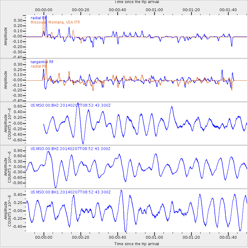
| Radial Match: |
68.75832 % |
| Radial Bump: |
356 |
| Transverse Match: |
62.443874 % |
| Transverse Bump: |
400 |
| SOD ConfigId: |
626651 |
| Insert Time: |
2014-04-20 16:05:26.812 +0000 |
| GWidth: |
2.5 |
| Max Bumps: |
400 |
| Tol: |
0.001 |
|
Signal To Noise
| Channel | StoN | STA | LTA |
| US:MSO:00:BHZ:20140207T08:52:43.300Z | 2.105052 | 5.500501E-7 | 2.6130002E-7 |
| US:MSO:00:BH1:20140207T08:52:43.300Z | 0.88330156 | 1.6677997E-7 | 1.888143E-7 |
| US:MSO:00:BH2:20140207T08:52:43.300Z | 0.76919544 | 2.418796E-7 | 3.1445794E-7 |
| Arrivals |
| Ps | |
| PpPs | |
| PsPs/PpSs | |


