You are here: Home > Network List > AV - Alaska Volcano Observatory Stations List
> Station SPCR Ckakachatna River, Mount Spurr, Alaska > Earthquake Result Viewer
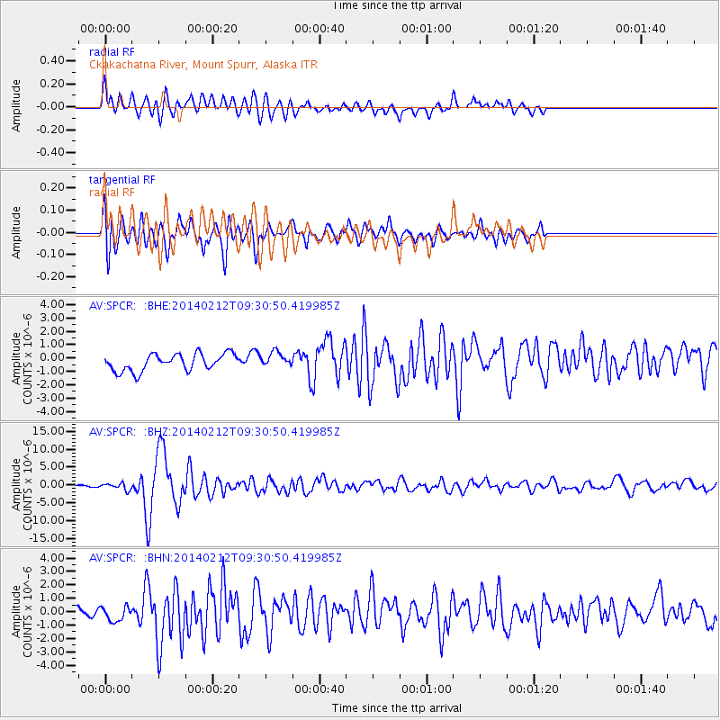
SPCR Ckakachatna River, Mount Spurr, Alaska - Earthquake Result Viewer
*The percent match for this event was below the threshold and hence no stack was calculated.
| Earthquake location: |
Xizang |
| Earthquake latitude/longitude: |
35.9/82.6 |
| Earthquake time(UTC): |
2014/02/12 (043) 09:19:49 GMT |
| Earthquake Depth: |
10 km |
| Earthquake Magnitude: |
6.9 MWW, 6.9 MWB, 6.9 MWC |
| Earthquake Catalog/Contributor: |
NEIC PDE/NEIC COMCAT |
|
| Network: |
AV Alaska Volcano Observatory |
| Station: |
SPCR Ckakachatna River, Mount Spurr, Alaska |
| Lat/Lon: |
61.20 N/152.21 W |
| Elevation: |
984 m |
|
| Distance: |
73.5 deg |
| Az: |
24.374 deg |
| Baz: |
316.22 deg |
| Ray Param: |
$rayparam |
*The percent match for this event was below the threshold and hence was not used in the summary stack. |
|
| Radial Match: |
72.684456 % |
| Radial Bump: |
400 |
| Transverse Match: |
76.73496 % |
| Transverse Bump: |
400 |
| SOD ConfigId: |
626651 |
| Insert Time: |
2014-04-20 16:42:18.114 +0000 |
| GWidth: |
2.5 |
| Max Bumps: |
400 |
| Tol: |
0.001 |
|
Signal To Noise
| Channel | StoN | STA | LTA |
| AV:SPCR: :BHZ:20140212T09:30:50.419985Z | 2.9071019 | 9.518624E-7 | 3.2742656E-7 |
| AV:SPCR: :BHN:20140212T09:30:50.419985Z | 1.3853095 | 5.9800044E-7 | 4.3167282E-7 |
| AV:SPCR: :BHE:20140212T09:30:50.419985Z | 0.88133264 | 5.557932E-7 | 6.306281E-7 |
| Arrivals |
| Ps | |
| PpPs | |
| PsPs/PpSs | |


