You are here: Home > Network List > UW - Pacific Northwest Regional Seismic Network Stations List
> Station MRBL Marblemount, WA, USA > Earthquake Result Viewer
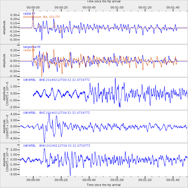
MRBL Marblemount, WA, USA - Earthquake Result Viewer
*The percent match for this event was below the threshold and hence no stack was calculated.
| Earthquake location: |
Xizang |
| Earthquake latitude/longitude: |
35.9/82.6 |
| Earthquake time(UTC): |
2014/02/12 (043) 09:19:49 GMT |
| Earthquake Depth: |
10 km |
| Earthquake Magnitude: |
6.9 MWW, 6.9 MWB, 6.9 MWC |
| Earthquake Catalog/Contributor: |
NEIC PDE/NEIC COMCAT |
|
| Network: |
UW Pacific Northwest Regional Seismic Network |
| Station: |
MRBL Marblemount, WA, USA |
| Lat/Lon: |
48.52 N/121.48 W |
| Elevation: |
75 m |
|
| Distance: |
93.3 deg |
| Az: |
15.761 deg |
| Baz: |
340.63 deg |
| Ray Param: |
$rayparam |
*The percent match for this event was below the threshold and hence was not used in the summary stack. |
|
| Radial Match: |
72.470116 % |
| Radial Bump: |
400 |
| Transverse Match: |
65.92614 % |
| Transverse Bump: |
400 |
| SOD ConfigId: |
626651 |
| Insert Time: |
2014-04-20 16:55:25.976 +0000 |
| GWidth: |
2.5 |
| Max Bumps: |
400 |
| Tol: |
0.001 |
|
Signal To Noise
| Channel | StoN | STA | LTA |
| UW:MRBL: :BHZ:20140212T09:32:32.073977Z | 1.9056315 | 5.6594706E-7 | 2.969866E-7 |
| UW:MRBL: :BHN:20140212T09:32:32.073977Z | 0.5277966 | 1.6256918E-7 | 3.0801482E-7 |
| UW:MRBL: :BHE:20140212T09:32:32.073977Z | 0.9050565 | 3.3547946E-7 | 3.7067238E-7 |
| Arrivals |
| Ps | |
| PpPs | |
| PsPs/PpSs | |


