You are here: Home > Network List > TA - USArray Transportable Network (new EarthScope stations) Stations List
> Station G59A Clarenceville, QC, USA > Earthquake Result Viewer
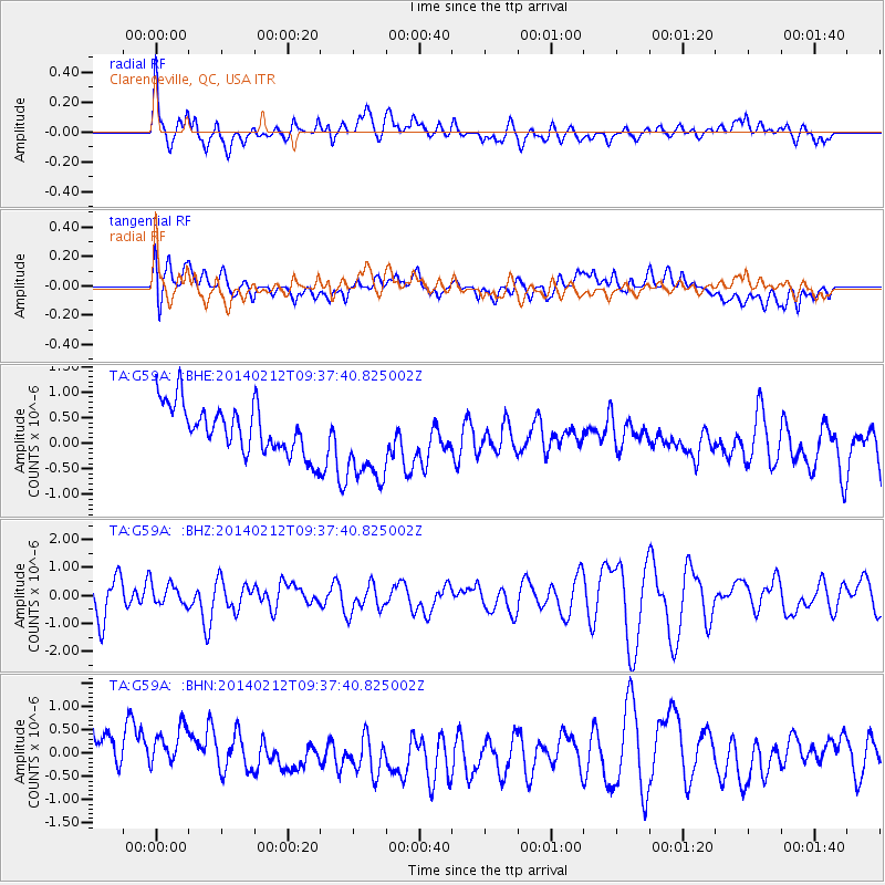
G59A Clarenceville, QC, USA - Earthquake Result Viewer
*The percent match for this event was below the threshold and hence no stack was calculated.
| Earthquake location: |
Xizang |
| Earthquake latitude/longitude: |
35.8/82.5 |
| Earthquake time(UTC): |
2014/02/12 (043) 09:24:43 GMT |
| Earthquake Depth: |
10 km |
| Earthquake Magnitude: |
5.7 MB |
| Earthquake Catalog/Contributor: |
NEIC PDE/NEIC COMCAT |
|
| Network: |
TA USArray Transportable Network (new EarthScope stations) |
| Station: |
G59A Clarenceville, QC, USA |
| Lat/Lon: |
45.08 N/73.18 W |
| Elevation: |
36 m |
|
| Distance: |
96.5 deg |
| Az: |
342.9 deg |
| Baz: |
19.712 deg |
| Ray Param: |
$rayparam |
*The percent match for this event was below the threshold and hence was not used in the summary stack. |
|
| Radial Match: |
72.46025 % |
| Radial Bump: |
400 |
| Transverse Match: |
31.888199 % |
| Transverse Bump: |
400 |
| SOD ConfigId: |
626651 |
| Insert Time: |
2014-04-20 17:07:26.345 +0000 |
| GWidth: |
2.5 |
| Max Bumps: |
400 |
| Tol: |
0.001 |
|
Signal To Noise
| Channel | StoN | STA | LTA |
| TA:G59A: :BHZ:20140212T09:37:40.825002Z | 0.647379 | 3.8952294E-7 | 6.016923E-7 |
| TA:G59A: :BHN:20140212T09:37:40.825002Z | 1.0763109 | 5.386943E-7 | 5.005006E-7 |
| TA:G59A: :BHE:20140212T09:37:40.825002Z | 1.7711108 | 8.322515E-7 | 4.699037E-7 |
| Arrivals |
| Ps | |
| PpPs | |
| PsPs/PpSs | |


