You are here: Home > Network List > GS - US Geological Survey Networks Stations List
> Station KAN10 Keim Farm > Earthquake Result Viewer
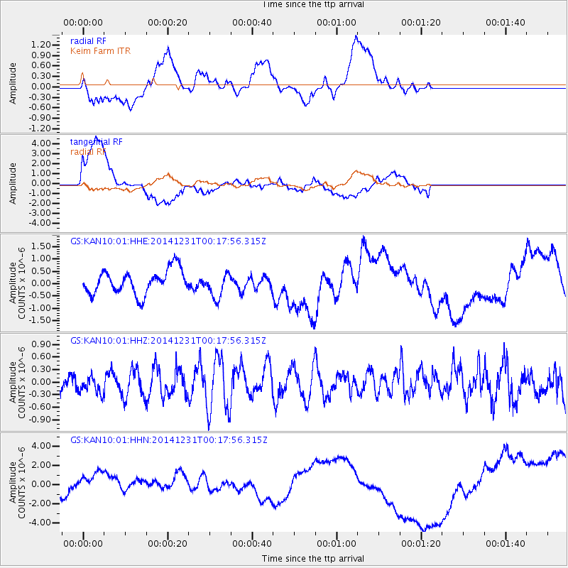
KAN10 Keim Farm - Earthquake Result Viewer
*The percent match for this event was below the threshold and hence no stack was calculated.
| Earthquake location: |
Fiji Islands Region |
| Earthquake latitude/longitude: |
-20.3/-178.5 |
| Earthquake time(UTC): |
2014/12/31 (365) 00:06:09 GMT |
| Earthquake Depth: |
606 km |
| Earthquake Magnitude: |
5.9 MW, 5.4 mb |
| Earthquake Catalog/Contributor: |
ISC/ISC |
|
| Network: |
GS US Geological Survey Networks |
| Station: |
KAN10 Keim Farm |
| Lat/Lon: |
37.12 N/98.10 W |
| Elevation: |
417 m |
|
| Distance: |
94.8 deg |
| Az: |
52.272 deg |
| Baz: |
248.245 deg |
| Ray Param: |
$rayparam |
*The percent match for this event was below the threshold and hence was not used in the summary stack. |
|
| Radial Match: |
51.487434 % |
| Radial Bump: |
400 |
| Transverse Match: |
46.39694 % |
| Transverse Bump: |
400 |
| SOD ConfigId: |
3390531 |
| Insert Time: |
2019-04-15 21:15:21.802 +0000 |
| GWidth: |
2.5 |
| Max Bumps: |
400 |
| Tol: |
0.001 |
|
Signal To Noise
| Channel | StoN | STA | LTA |
| GS:KAN10:01:HHZ:20141231T00:17:56.315Z | 1.251286 | 2.1568844E-7 | 1.723734E-7 |
| GS:KAN10:01:HHN:20141231T00:17:56.315Z | 1.6086384 | 1.8476503E-6 | 1.1485803E-6 |
| GS:KAN10:01:HHE:20141231T00:17:56.315Z | 1.0756714 | 5.2534716E-7 | 4.8839E-7 |
| Arrivals |
| Ps | |
| PpPs | |
| PsPs/PpSs | |


