You are here: Home > Network List > AZ - ANZA Regional Network Stations List
> Station SMER AZ.SMER > Earthquake Result Viewer
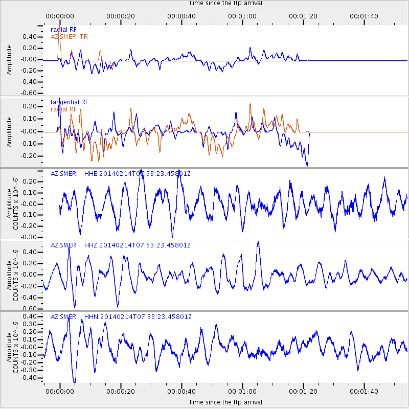
SMER AZ.SMER - Earthquake Result Viewer
*The percent match for this event was below the threshold and hence no stack was calculated.
| Earthquake location: |
Easter Island Region |
| Earthquake latitude/longitude: |
-23.0/-114.3 |
| Earthquake time(UTC): |
2014/02/14 (045) 07:44:15 GMT |
| Earthquake Depth: |
12 km |
| Earthquake Magnitude: |
5.6 MWW, 5.5 MWB, 5.6 MWC |
| Earthquake Catalog/Contributor: |
NEIC PDE/NEIC COMCAT |
|
| Network: |
AZ ANZA Regional Network |
| Station: |
SMER AZ.SMER |
| Lat/Lon: |
33.46 N/117.17 W |
| Elevation: |
355 m |
|
| Distance: |
56.2 deg |
| Az: |
357.141 deg |
| Baz: |
176.848 deg |
| Ray Param: |
$rayparam |
*The percent match for this event was below the threshold and hence was not used in the summary stack. |
|
| Radial Match: |
34.921715 % |
| Radial Bump: |
400 |
| Transverse Match: |
41.72816 % |
| Transverse Bump: |
400 |
| SOD ConfigId: |
626651 |
| Insert Time: |
2014-04-20 17:50:29.184 +0000 |
| GWidth: |
2.5 |
| Max Bumps: |
400 |
| Tol: |
0.001 |
|
Signal To Noise
| Channel | StoN | STA | LTA |
| AZ:SMER: :HHZ:20140214T07:53:23.45801Z | 1.7645725 | 2.4722803E-7 | 1.4010648E-7 |
| AZ:SMER: :HHN:20140214T07:53:23.45801Z | 3.2790194 | 2.2896795E-7 | 6.9828175E-8 |
| AZ:SMER: :HHE:20140214T07:53:23.45801Z | 0.99324334 | 1.163223E-7 | 1.1711359E-7 |
| Arrivals |
| Ps | |
| PpPs | |
| PsPs/PpSs | |


