You are here: Home > Network List > TA - USArray Transportable Network (new EarthScope stations) Stations List
> Station K22A Casper, WY, USA > Earthquake Result Viewer
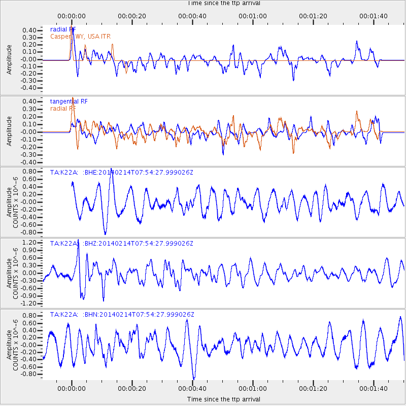
K22A Casper, WY, USA - Earthquake Result Viewer
*The percent match for this event was below the threshold and hence no stack was calculated.
| Earthquake location: |
Easter Island Region |
| Earthquake latitude/longitude: |
-23.0/-114.3 |
| Earthquake time(UTC): |
2014/02/14 (045) 07:44:15 GMT |
| Earthquake Depth: |
12 km |
| Earthquake Magnitude: |
5.6 MWW, 5.5 MWB, 5.6 MWC |
| Earthquake Catalog/Contributor: |
NEIC PDE/NEIC COMCAT |
|
| Network: |
TA USArray Transportable Network (new EarthScope stations) |
| Station: |
K22A Casper, WY, USA |
| Lat/Lon: |
42.65 N/106.52 W |
| Elevation: |
1686 m |
|
| Distance: |
65.7 deg |
| Az: |
6.314 deg |
| Baz: |
187.897 deg |
| Ray Param: |
$rayparam |
*The percent match for this event was below the threshold and hence was not used in the summary stack. |
|
| Radial Match: |
47.87111 % |
| Radial Bump: |
400 |
| Transverse Match: |
44.62681 % |
| Transverse Bump: |
400 |
| SOD ConfigId: |
626651 |
| Insert Time: |
2014-04-20 18:06:29.572 +0000 |
| GWidth: |
2.5 |
| Max Bumps: |
400 |
| Tol: |
0.001 |
|
Signal To Noise
| Channel | StoN | STA | LTA |
| TA:K22A: :BHZ:20140214T07:54:27.999026Z | 3.2838533 | 6.2899693E-7 | 1.9154233E-7 |
| TA:K22A: :BHN:20140214T07:54:27.999026Z | 1.2421085 | 3.6185065E-7 | 2.913197E-7 |
| TA:K22A: :BHE:20140214T07:54:27.999026Z | 0.32988426 | 1.1944466E-7 | 3.6208053E-7 |
| Arrivals |
| Ps | |
| PpPs | |
| PsPs/PpSs | |


