You are here: Home > Network List > US - United States National Seismic Network Stations List
> Station EGMT Eagleton, Montana, USA > Earthquake Result Viewer
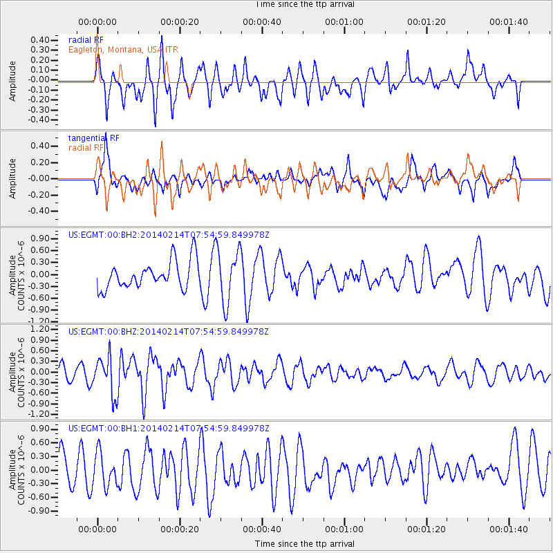
EGMT Eagleton, Montana, USA - Earthquake Result Viewer
*The percent match for this event was below the threshold and hence no stack was calculated.
| Earthquake location: |
Easter Island Region |
| Earthquake latitude/longitude: |
-23.0/-114.3 |
| Earthquake time(UTC): |
2014/02/14 (045) 07:44:15 GMT |
| Earthquake Depth: |
12 km |
| Earthquake Magnitude: |
5.6 MWW, 5.5 MWB, 5.6 MWC |
| Earthquake Catalog/Contributor: |
NEIC PDE/NEIC COMCAT |
|
| Network: |
US United States National Seismic Network |
| Station: |
EGMT Eagleton, Montana, USA |
| Lat/Lon: |
48.02 N/109.75 W |
| Elevation: |
1055 m |
|
| Distance: |
70.8 deg |
| Az: |
3.251 deg |
| Baz: |
184.467 deg |
| Ray Param: |
$rayparam |
*The percent match for this event was below the threshold and hence was not used in the summary stack. |
|
| Radial Match: |
42.873196 % |
| Radial Bump: |
400 |
| Transverse Match: |
41.827976 % |
| Transverse Bump: |
400 |
| SOD ConfigId: |
626651 |
| Insert Time: |
2014-04-20 18:11:45.908 +0000 |
| GWidth: |
2.5 |
| Max Bumps: |
400 |
| Tol: |
0.001 |
|
Signal To Noise
| Channel | StoN | STA | LTA |
| US:EGMT:00:BHZ:20140214T07:54:59.849978Z | 2.9607408 | 5.530564E-7 | 1.8679661E-7 |
| US:EGMT:00:BH1:20140214T07:54:59.849978Z | 0.8209623 | 3.7020203E-7 | 4.5093668E-7 |
| US:EGMT:00:BH2:20140214T07:54:59.849978Z | 1.9318926 | 6.6674863E-7 | 3.4512715E-7 |
| Arrivals |
| Ps | |
| PpPs | |
| PsPs/PpSs | |


