You are here: Home > Network List > CI - Caltech Regional Seismic Network Stations List
> Station MPM Manuel Prospect Mine, California, USA > Earthquake Result Viewer
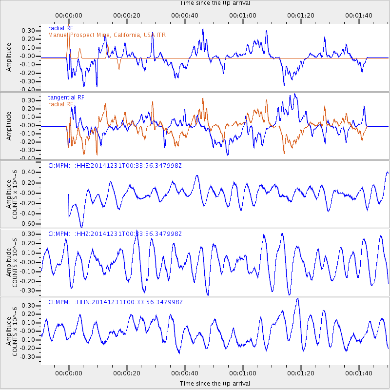
MPM Manuel Prospect Mine, California, USA - Earthquake Result Viewer
*The percent match for this event was below the threshold and hence no stack was calculated.
| Earthquake location: |
South Of Mariana Islands |
| Earthquake latitude/longitude: |
13.8/146.2 |
| Earthquake time(UTC): |
2014/12/31 (365) 00:21:48 GMT |
| Earthquake Depth: |
60 km |
| Earthquake Magnitude: |
5.1 mb |
| Earthquake Catalog/Contributor: |
ISC/ISC |
|
| Network: |
CI Caltech Regional Seismic Network |
| Station: |
MPM Manuel Prospect Mine, California, USA |
| Lat/Lon: |
36.06 N/117.49 W |
| Elevation: |
185 m |
|
| Distance: |
87.0 deg |
| Az: |
53.763 deg |
| Baz: |
284.738 deg |
| Ray Param: |
$rayparam |
*The percent match for this event was below the threshold and hence was not used in the summary stack. |
|
| Radial Match: |
45.28301 % |
| Radial Bump: |
400 |
| Transverse Match: |
50.64198 % |
| Transverse Bump: |
400 |
| SOD ConfigId: |
3390531 |
| Insert Time: |
2019-04-15 21:21:52.085 +0000 |
| GWidth: |
2.5 |
| Max Bumps: |
400 |
| Tol: |
0.001 |
|
Signal To Noise
| Channel | StoN | STA | LTA |
| CI:MPM: :HHZ:20141231T00:33:56.347998Z | 1.2603407 | 1.4903615E-7 | 1.1825069E-7 |
| CI:MPM: :HHN:20141231T00:33:56.347998Z | 0.8357872 | 1.2550993E-7 | 1.5016973E-7 |
| CI:MPM: :HHE:20141231T00:33:56.347998Z | 0.69193524 | 1.3434057E-7 | 1.9415192E-7 |
| Arrivals |
| Ps | |
| PpPs | |
| PsPs/PpSs | |


