You are here: Home > Network List > IU - Global Seismograph Network (GSN - IRIS/USGS) Stations List
> Station CTAO Charters Towers, Australia > Earthquake Result Viewer
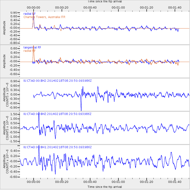
CTAO Charters Towers, Australia - Earthquake Result Viewer
*The percent match for this event was below the threshold and hence no stack was calculated.
| Earthquake location: |
South Of Kermadec Islands |
| Earthquake latitude/longitude: |
-34.8/-179.4 |
| Earthquake time(UTC): |
2014/02/18 (049) 08:14:42 GMT |
| Earthquake Depth: |
27 km |
| Earthquake Magnitude: |
5.6 MWC, 5.6 MWC |
| Earthquake Catalog/Contributor: |
NEIC PDE/NEIC COMCAT |
|
| Network: |
IU Global Seismograph Network (GSN - IRIS/USGS) |
| Station: |
CTAO Charters Towers, Australia |
| Lat/Lon: |
20.09 S/146.25 E |
| Elevation: |
357 m |
|
| Distance: |
33.6 deg |
| Az: |
286.795 deg |
| Baz: |
123.046 deg |
| Ray Param: |
$rayparam |
*The percent match for this event was below the threshold and hence was not used in the summary stack. |
|
| Radial Match: |
74.03674 % |
| Radial Bump: |
350 |
| Transverse Match: |
48.22728 % |
| Transverse Bump: |
400 |
| SOD ConfigId: |
626651 |
| Insert Time: |
2014-04-20 18:34:15.492 +0000 |
| GWidth: |
2.5 |
| Max Bumps: |
400 |
| Tol: |
0.001 |
|
Signal To Noise
| Channel | StoN | STA | LTA |
| IU:CTAO:00:BHZ:20140218T08:20:50.093986Z | 3.2729793 | 4.7218109E-7 | 1.4426644E-7 |
| IU:CTAO:00:BH1:20140218T08:20:50.093986Z | 2.415706 | 1.7736812E-7 | 7.3422896E-8 |
| IU:CTAO:00:BH2:20140218T08:20:50.093986Z | 3.3860714 | 3.03188E-7 | 8.9539746E-8 |
| Arrivals |
| Ps | |
| PpPs | |
| PsPs/PpSs | |


