
PAYG Puerto Ayora, Galapagos Islands - Earthquake Result Viewer
| ||||||||||||||||||
| ||||||||||||||||||
| ||||||||||||||||||
|
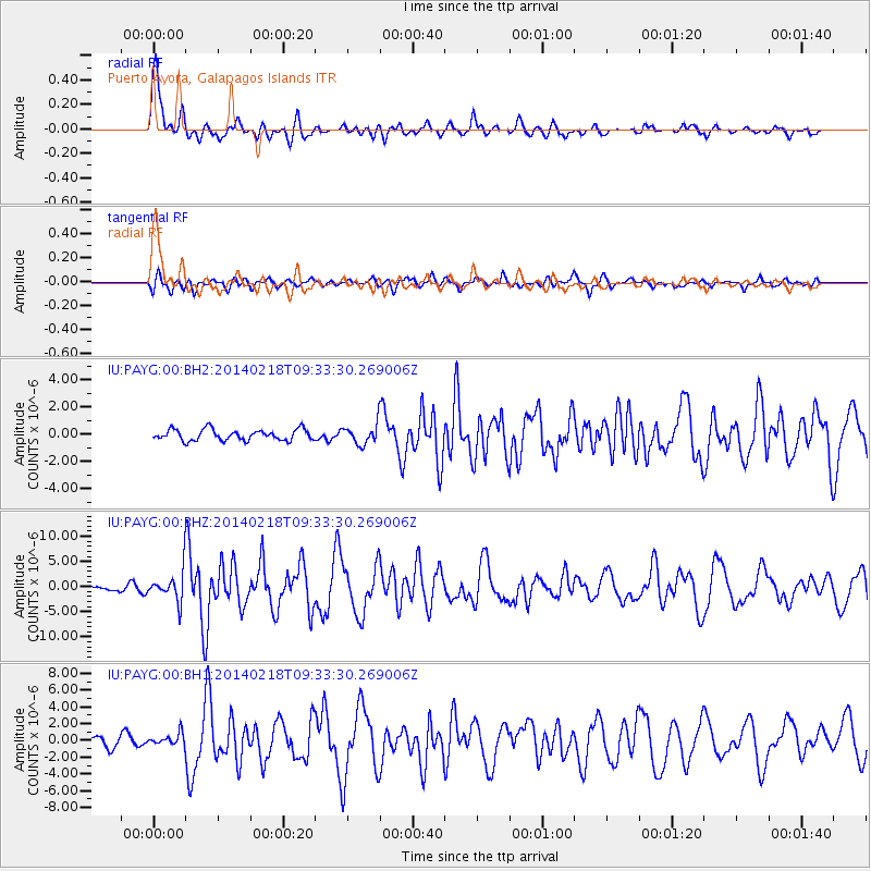
Signal To Noise
| Channel | StoN | STA | LTA |
| IU:PAYG:00:BHZ:20140218T09:33:30.269006Z | 4.278794 | 2.8848344E-6 | 6.742168E-7 |
| IU:PAYG:00:BH1:20140218T09:33:30.269006Z | 1.4502232 | 6.9803093E-7 | 4.8132654E-7 |
| IU:PAYG:00:BH2:20140218T09:33:30.269006Z | 1.8221014 | 7.324828E-7 | 4.0199893E-7 |
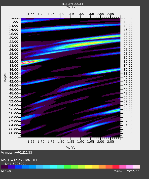
| Arrivals | |
| Ps | 4.4 SECOND |
| PpPs | 17 SECOND |
| PsPs/PpSs | 21 SECOND |

