You are here: Home > Network List > II - Global Seismograph Network (GSN - IRIS/IDA) Stations List
> Station WRAB Tennant Creek, NT, Australia > Earthquake Result Viewer
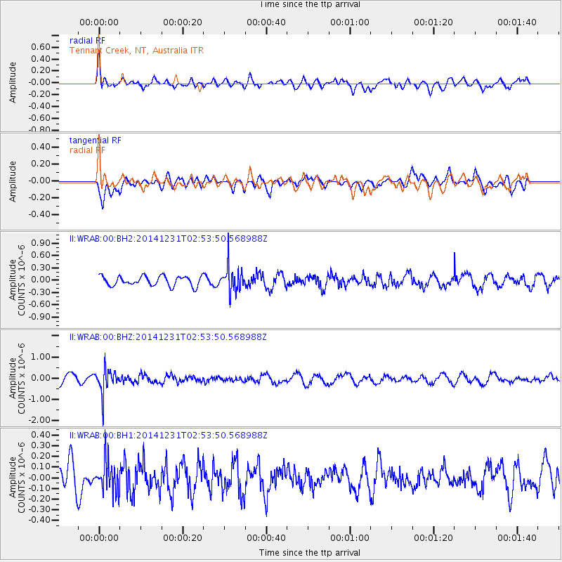
WRAB Tennant Creek, NT, Australia - Earthquake Result Viewer
*The percent match for this event was below the threshold and hence no stack was calculated.
| Earthquake location: |
South Of Fiji Islands |
| Earthquake latitude/longitude: |
-25.5/178.2 |
| Earthquake time(UTC): |
2014/12/31 (365) 02:47:31 GMT |
| Earthquake Depth: |
609 km |
| Earthquake Magnitude: |
5.5 MW, 5.1 mb |
| Earthquake Catalog/Contributor: |
ISC/ISC |
|
| Network: |
II Global Seismograph Network (GSN - IRIS/IDA) |
| Station: |
WRAB Tennant Creek, NT, Australia |
| Lat/Lon: |
19.93 S/134.36 E |
| Elevation: |
366 m |
|
| Distance: |
40.7 deg |
| Az: |
268.602 deg |
| Baz: |
106.198 deg |
| Ray Param: |
$rayparam |
*The percent match for this event was below the threshold and hence was not used in the summary stack. |
|
| Radial Match: |
55.972515 % |
| Radial Bump: |
400 |
| Transverse Match: |
53.426743 % |
| Transverse Bump: |
400 |
| SOD ConfigId: |
3390531 |
| Insert Time: |
2019-04-15 21:34:08.068 +0000 |
| GWidth: |
2.5 |
| Max Bumps: |
400 |
| Tol: |
0.001 |
|
Signal To Noise
| Channel | StoN | STA | LTA |
| II:WRAB:00:BHZ:20141231T02:53:50.568988Z | 2.9495704 | 5.442862E-7 | 1.8453066E-7 |
| II:WRAB:00:BH1:20141231T02:53:50.568988Z | 0.89644086 | 1.462025E-7 | 1.6309218E-7 |
| II:WRAB:00:BH2:20141231T02:53:50.568988Z | 2.5841877 | 3.043614E-7 | 1.1777836E-7 |
| Arrivals |
| Ps | |
| PpPs | |
| PsPs/PpSs | |


