You are here: Home > Network List > TA - USArray Transportable Network (new EarthScope stations) Stations List
> Station L04D Klamath Falls, OR, USA > Earthquake Result Viewer
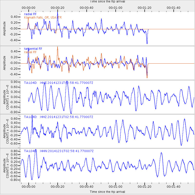
L04D Klamath Falls, OR, USA - Earthquake Result Viewer
*The percent match for this event was below the threshold and hence no stack was calculated.
| Earthquake location: |
South Of Fiji Islands |
| Earthquake latitude/longitude: |
-25.5/178.2 |
| Earthquake time(UTC): |
2014/12/31 (365) 02:47:31 GMT |
| Earthquake Depth: |
609 km |
| Earthquake Magnitude: |
5.5 MW, 5.1 mb |
| Earthquake Catalog/Contributor: |
ISC/ISC |
|
| Network: |
TA USArray Transportable Network (new EarthScope stations) |
| Station: |
L04D Klamath Falls, OR, USA |
| Lat/Lon: |
42.22 N/122.30 W |
| Elevation: |
1437 m |
|
| Distance: |
86.9 deg |
| Az: |
39.853 deg |
| Baz: |
231.227 deg |
| Ray Param: |
$rayparam |
*The percent match for this event was below the threshold and hence was not used in the summary stack. |
|
| Radial Match: |
67.414375 % |
| Radial Bump: |
400 |
| Transverse Match: |
41.097202 % |
| Transverse Bump: |
400 |
| SOD ConfigId: |
3390531 |
| Insert Time: |
2019-04-15 21:34:59.613 +0000 |
| GWidth: |
2.5 |
| Max Bumps: |
400 |
| Tol: |
0.001 |
|
Signal To Noise
| Channel | StoN | STA | LTA |
| TA:L04D: :HHZ:20141231T02:58:41.770007Z | 1.2627207 | 3.1191527E-7 | 2.4701842E-7 |
| TA:L04D: :HHN:20141231T02:58:41.770007Z | 2.3294973 | 5.031292E-7 | 2.1598186E-7 |
| TA:L04D: :HHE:20141231T02:58:41.770007Z | 1.129682 | 5.0791255E-7 | 4.4960666E-7 |
| Arrivals |
| Ps | |
| PpPs | |
| PsPs/PpSs | |


