CGRP Cima Grappa - Earthquake Result Viewer
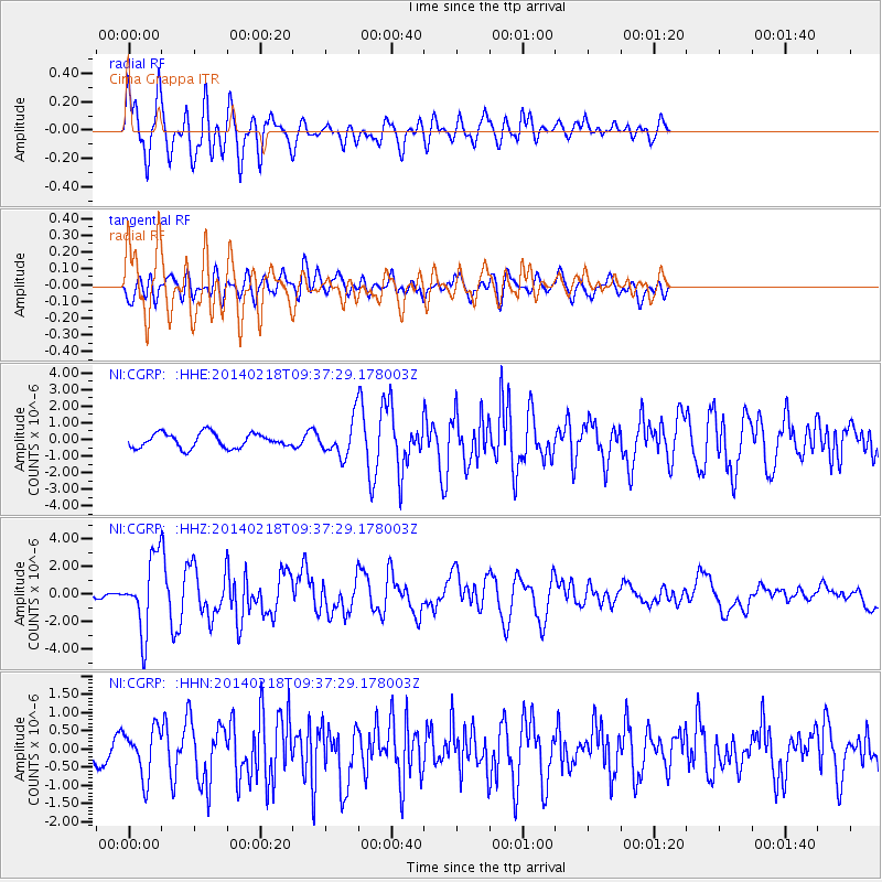
Earthquake location: North Atlantic Ocean
Earthquake latitude/longitude: 14.7/-58.9
Earthquake time(UTC): 2014/02/18 (049) 09:27:13 GMT
Earthquake Depth: 17 km
Earthquake Magnitude: 6.5 MWW, 6.3 MWB, 6.5 MWC, 6.6 MWC, 6.7 MI
Earthquake Catalog/Contributor: NEIC PDE/NEIC COMCAT
Network: NI North-East Italy Broadband Network
Station: CGRP Cima Grappa
Lat/Lon: 45.88 N/11.80 E
Elevation: 1757 m
Distance: 66.2 deg
Az: 46.098 deg
Baz: 266.684 deg
Ray Param: 0.057733104
Estimated Moho Depth: 35.75 km
Estimated Crust Vp/Vs: 1.77
Assumed Crust Vp: 6.155 km/s
Estimated Crust Vs: 3.482 km/s
Estimated Crust Poisson's Ratio: 0.26
Radial Match: 84.73058 %
Radial Bump: 400
Transverse Match: 72.96 %
Transverse Bump: 400
SOD ConfigId: 626651
Insert Time: 2014-04-20 19:04:18.735 +0000
GWidth: 2.5
Max Bumps: 400
Tol: 0.001

Signal To Noise

ChannelStoNSTALTA
NI:CGRP: :HHZ:20140218T09:37:29.178003Z9.7276062.5807979E-62.653066E-7
NI:CGRP: :HHN:20140218T09:37:29.178003Z3.04271346.577259E-72.1616427E-7
NI:CGRP: :HHE:20140218T09:37:29.178003Z2.37604281.0351417E-64.3565785E-7
Arrivals
Ps4.6 SECOND
PpPs15 SECOND
PsPs/PpSs20 SECOND