
WRPS We R Penn State - Earthquake Result Viewer
| ||||||||||||||||||
| ||||||||||||||||||
| ||||||||||||||||||
|
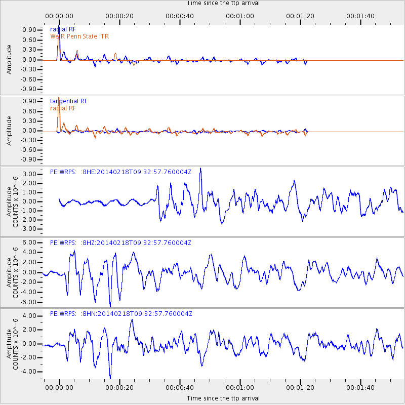
Signal To Noise
| Channel | StoN | STA | LTA |
| PE:WRPS: :BHZ:20140218T09:32:57.760004Z | 19.089283 | 2.2361633E-6 | 1.1714233E-7 |
| PE:WRPS: :BHN:20140218T09:32:57.760004Z | 3.9550116 | 1.0232072E-6 | 2.5871157E-7 |
| PE:WRPS: :BHE:20140218T09:32:57.760004Z | 4.837229 | 9.834938E-7 | 2.0331761E-7 |
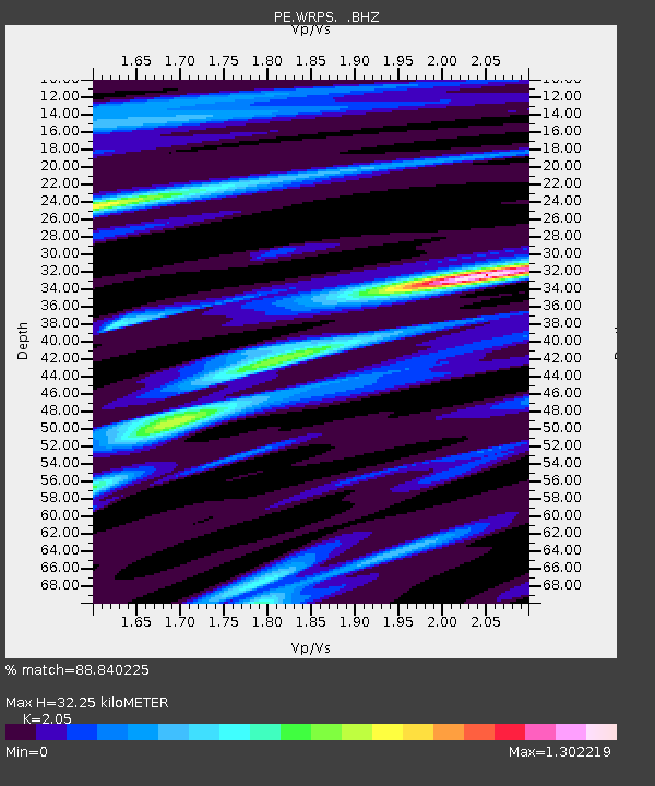
| Arrivals | |
| Ps | 5.9 SECOND |
| PpPs | 15 SECOND |
| PsPs/PpSs | 21 SECOND |

