You are here: Home > Network List > UW - Pacific Northwest Regional Seismic Network Stations List
> Station LEBA Lebam, WA, USA > Earthquake Result Viewer
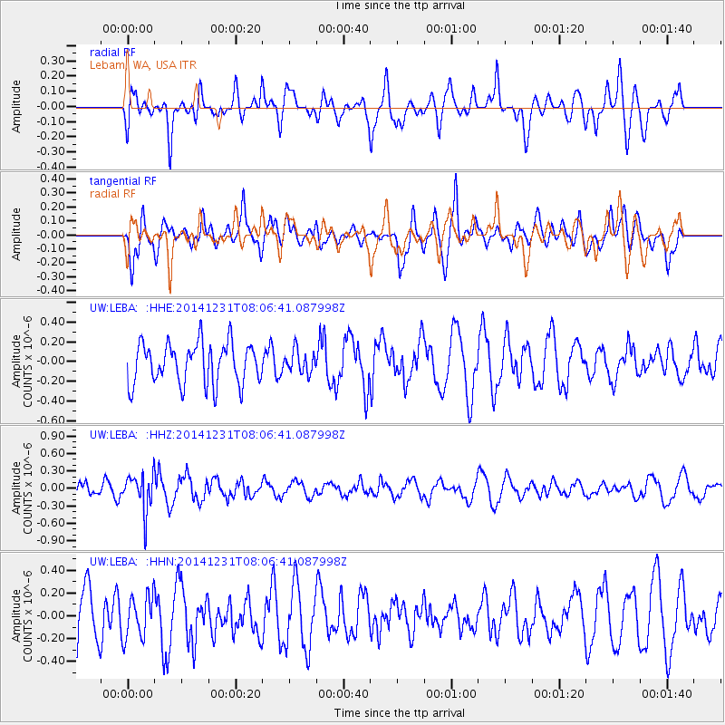
LEBA Lebam, WA, USA - Earthquake Result Viewer
*The percent match for this event was below the threshold and hence no stack was calculated.
| Earthquake location: |
Taiwan Region |
| Earthquake latitude/longitude: |
24.7/122.6 |
| Earthquake time(UTC): |
2014/12/31 (365) 07:54:36 GMT |
| Earthquake Depth: |
104 km |
| Earthquake Magnitude: |
5.0 MW, 5.5 ML, 5.2 mb |
| Earthquake Catalog/Contributor: |
ISC/ISC |
|
| Network: |
UW Pacific Northwest Regional Seismic Network |
| Station: |
LEBA Lebam, WA, USA |
| Lat/Lon: |
46.55 N/123.56 W |
| Elevation: |
73 m |
|
| Distance: |
87.4 deg |
| Az: |
39.183 deg |
| Baz: |
303.613 deg |
| Ray Param: |
$rayparam |
*The percent match for this event was below the threshold and hence was not used in the summary stack. |
|
| Radial Match: |
56.211315 % |
| Radial Bump: |
400 |
| Transverse Match: |
41.081116 % |
| Transverse Bump: |
400 |
| SOD ConfigId: |
3390531 |
| Insert Time: |
2019-04-15 21:41:06.375 +0000 |
| GWidth: |
2.5 |
| Max Bumps: |
400 |
| Tol: |
0.001 |
|
Signal To Noise
| Channel | StoN | STA | LTA |
| UW:LEBA: :HHZ:20141231T08:06:41.087998Z | 1.9589627 | 3.1518547E-7 | 1.6089406E-7 |
| UW:LEBA: :HHN:20141231T08:06:41.087998Z | 0.8975951 | 1.8934048E-7 | 2.1094198E-7 |
| UW:LEBA: :HHE:20141231T08:06:41.087998Z | 0.55663973 | 1.1584517E-7 | 2.0811517E-7 |
| Arrivals |
| Ps | |
| PpPs | |
| PsPs/PpSs | |


