You are here: Home > Network List > UW - Pacific Northwest Regional Seismic Network Stations List
> Station MRBL Marblemount, WA, USA > Earthquake Result Viewer
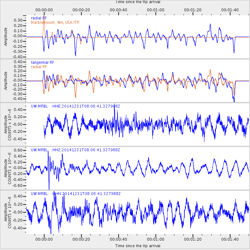
MRBL Marblemount, WA, USA - Earthquake Result Viewer
*The percent match for this event was below the threshold and hence no stack was calculated.
| Earthquake location: |
Taiwan Region |
| Earthquake latitude/longitude: |
24.7/122.6 |
| Earthquake time(UTC): |
2014/12/31 (365) 07:54:36 GMT |
| Earthquake Depth: |
104 km |
| Earthquake Magnitude: |
5.0 MW, 5.5 ML, 5.2 mb |
| Earthquake Catalog/Contributor: |
ISC/ISC |
|
| Network: |
UW Pacific Northwest Regional Seismic Network |
| Station: |
MRBL Marblemount, WA, USA |
| Lat/Lon: |
48.52 N/121.48 W |
| Elevation: |
75 m |
|
| Distance: |
87.4 deg |
| Az: |
36.756 deg |
| Baz: |
305.031 deg |
| Ray Param: |
$rayparam |
*The percent match for this event was below the threshold and hence was not used in the summary stack. |
|
| Radial Match: |
50.88552 % |
| Radial Bump: |
400 |
| Transverse Match: |
49.08388 % |
| Transverse Bump: |
400 |
| SOD ConfigId: |
3390531 |
| Insert Time: |
2019-04-15 21:41:06.601 +0000 |
| GWidth: |
2.5 |
| Max Bumps: |
400 |
| Tol: |
0.001 |
|
Signal To Noise
| Channel | StoN | STA | LTA |
| UW:MRBL: :HHZ:20141231T08:06:41.327988Z | 2.0034254 | 2.3067172E-7 | 1.15138654E-7 |
| UW:MRBL: :HHN:20141231T08:06:41.327988Z | 2.1435325 | 2.1464471E-7 | 1.0013598E-7 |
| UW:MRBL: :HHE:20141231T08:06:41.327988Z | 0.61909807 | 9.231696E-8 | 1.4911524E-7 |
| Arrivals |
| Ps | |
| PpPs | |
| PsPs/PpSs | |


