You are here: Home > Network List > TA - USArray Transportable Network (new EarthScope stations) Stations List
> Station E52A Mattawa, ON, CAN > Earthquake Result Viewer
E52A Mattawa, ON, CAN - Earthquake Result Viewer

| Earthquake location: |
North Atlantic Ocean |
| Earthquake latitude/longitude: |
14.7/-58.9 |
| Earthquake time(UTC): |
2014/02/18 (049) 09:27:13 GMT |
| Earthquake Depth: |
17 km |
| Earthquake Magnitude: |
6.5 MWW, 6.3 MWB, 6.5 MWC, 6.6 MWC, 6.7 MI |
| Earthquake Catalog/Contributor: |
NEIC PDE/NEIC COMCAT |
|
| Network: |
TA USArray Transportable Network (new EarthScope stations) |
| Station: |
E52A Mattawa, ON, CAN |
| Lat/Lon: |
46.29 N/78.66 W |
| Elevation: |
252 m |
|
| Distance: |
35.6 deg |
| Az: |
336.3 deg |
| Baz: |
145.876 deg |
| Ray Param: |
0.07711002 |
| Estimated Moho Depth: |
38.75 km |
| Estimated Crust Vp/Vs: |
1.66 |
| Assumed Crust Vp: |
6.622 km/s |
| Estimated Crust Vs: |
3.977 km/s |
| Estimated Crust Poisson's Ratio: |
0.22 |
|
| Radial Match: |
88.19927 % |
| Radial Bump: |
390 |
| Transverse Match: |
70.596016 % |
| Transverse Bump: |
400 |
| SOD ConfigId: |
626651 |
| Insert Time: |
2014-04-20 19:10:41.134 +0000 |
| GWidth: |
2.5 |
| Max Bumps: |
400 |
| Tol: |
0.001 |
|
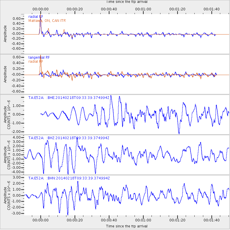
Signal To Noise
| Channel | StoN | STA | LTA |
| TA:E52A: :BHZ:20140218T09:33:39.374994Z | 4.95873 | 2.246485E-6 | 4.5303636E-7 |
| TA:E52A: :BHN:20140218T09:33:39.374994Z | 3.4413953 | 1.014067E-6 | 2.946674E-7 |
| TA:E52A: :BHE:20140218T09:33:39.374994Z | 1.5067034 | 6.7370115E-7 | 4.4713587E-7 |
| Arrivals |
| Ps | 4.2 SECOND |
| PpPs | 14 SECOND |
| PsPs/PpSs | 19 SECOND |


