You are here: Home > Network List > TA - USArray Transportable Network (new EarthScope stations) Stations List
> Station J48A Bridge Port, MI, USA > Earthquake Result Viewer
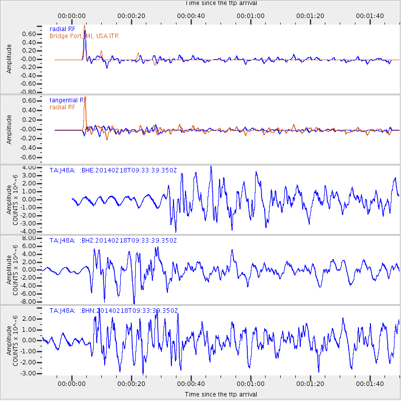
J48A Bridge Port, MI, USA - Earthquake Result Viewer
*The percent match for this event was below the threshold and hence no stack was calculated.
| Earthquake location: |
North Atlantic Ocean |
| Earthquake latitude/longitude: |
14.7/-58.9 |
| Earthquake time(UTC): |
2014/02/18 (049) 09:27:13 GMT |
| Earthquake Depth: |
17 km |
| Earthquake Magnitude: |
6.5 MWW, 6.3 MWB, 6.5 MWC, 6.6 MWC, 6.7 MI |
| Earthquake Catalog/Contributor: |
NEIC PDE/NEIC COMCAT |
|
| Network: |
TA USArray Transportable Network (new EarthScope stations) |
| Station: |
J48A Bridge Port, MI, USA |
| Lat/Lon: |
43.30 N/82.78 W |
| Elevation: |
195 m |
|
| Distance: |
35.1 deg |
| Az: |
329.112 deg |
| Baz: |
137.112 deg |
| Ray Param: |
$rayparam |
*The percent match for this event was below the threshold and hence was not used in the summary stack. |
|
| Radial Match: |
85.92741 % |
| Radial Bump: |
340 |
| Transverse Match: |
68.63843 % |
| Transverse Bump: |
400 |
| SOD ConfigId: |
626651 |
| Insert Time: |
2014-04-20 19:15:00.264 +0000 |
| GWidth: |
2.5 |
| Max Bumps: |
400 |
| Tol: |
0.001 |
|
Signal To Noise
| Channel | StoN | STA | LTA |
| TA:J48A: :BHZ:20140218T09:33:39.350Z | 1.1487793 | 5.8089245E-7 | 5.0566064E-7 |
| TA:J48A: :BHN:20140218T09:33:39.350Z | 0.56048185 | 2.1557697E-7 | 3.8462792E-7 |
| TA:J48A: :BHE:20140218T09:33:39.350Z | 1.7014469 | 5.664771E-7 | 3.3293844E-7 |
| Arrivals |
| Ps | |
| PpPs | |
| PsPs/PpSs | |


