You are here: Home > Network List > TA - USArray Transportable Network (new EarthScope stations) Stations List
> Station J56A Wolcott, NY, USA > Earthquake Result Viewer
J56A Wolcott, NY, USA - Earthquake Result Viewer

| Earthquake location: |
North Atlantic Ocean |
| Earthquake latitude/longitude: |
14.7/-58.9 |
| Earthquake time(UTC): |
2014/02/18 (049) 09:27:13 GMT |
| Earthquake Depth: |
17 km |
| Earthquake Magnitude: |
6.5 MWW, 6.3 MWB, 6.5 MWC, 6.6 MWC, 6.7 MI |
| Earthquake Catalog/Contributor: |
NEIC PDE/NEIC COMCAT |
|
| Network: |
TA USArray Transportable Network (new EarthScope stations) |
| Station: |
J56A Wolcott, NY, USA |
| Lat/Lon: |
43.28 N/76.86 W |
| Elevation: |
93 m |
|
| Distance: |
32.4 deg |
| Az: |
335.197 deg |
| Baz: |
146.224 deg |
| Ray Param: |
0.078651786 |
| Estimated Moho Depth: |
13.25 km |
| Estimated Crust Vp/Vs: |
2.07 |
| Assumed Crust Vp: |
6.476 km/s |
| Estimated Crust Vs: |
3.132 km/s |
| Estimated Crust Poisson's Ratio: |
0.35 |
|
| Radial Match: |
89.11772 % |
| Radial Bump: |
400 |
| Transverse Match: |
67.58457 % |
| Transverse Bump: |
400 |
| SOD ConfigId: |
626651 |
| Insert Time: |
2014-04-20 19:15:17.632 +0000 |
| GWidth: |
2.5 |
| Max Bumps: |
400 |
| Tol: |
0.001 |
|
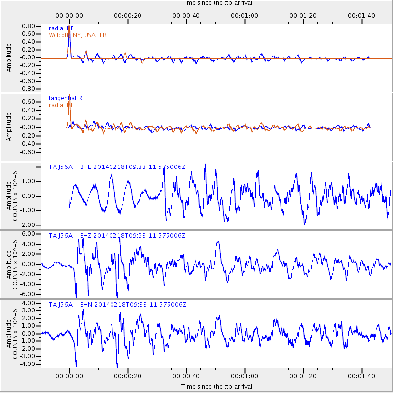
Signal To Noise
| Channel | StoN | STA | LTA |
| TA:J56A: :BHZ:20140218T09:33:11.575006Z | 4.2897935 | 2.9046575E-6 | 6.7710897E-7 |
| TA:J56A: :BHN:20140218T09:33:11.575006Z | 4.0978527 | 1.7499832E-6 | 4.270488E-7 |
| TA:J56A: :BHE:20140218T09:33:11.575006Z | 1.4024588 | 9.123745E-7 | 6.5055355E-7 |
| Arrivals |
| Ps | 2.3 SECOND |
| PpPs | 5.9 SECOND |
| PsPs/PpSs | 8.2 SECOND |


