You are here: Home > Network List > TJ - Tajikistan National Seismic Network Stations List
> Station GARM Garm, Tajikistan > Earthquake Result Viewer
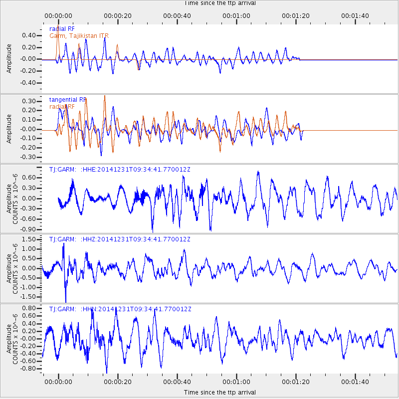
GARM Garm, Tajikistan - Earthquake Result Viewer
*The percent match for this event was below the threshold and hence no stack was calculated.
| Earthquake location: |
Mindoro, Philippines |
| Earthquake latitude/longitude: |
13.8/120.7 |
| Earthquake time(UTC): |
2014/12/31 (365) 09:26:25 GMT |
| Earthquake Depth: |
134 km |
| Earthquake Magnitude: |
5.5 MW, 3.9 ms1mx, 4.1 Ms1, 4.1 MS, 5.0 mbtmp, 4.6 mb1mx, 4.7 mb1, 4.7 mb |
| Earthquake Catalog/Contributor: |
ISC/ISC |
|
| Network: |
TJ Tajikistan National Seismic Network |
| Station: |
GARM Garm, Tajikistan |
| Lat/Lon: |
39.00 N/70.32 E |
| Elevation: |
1305 m |
|
| Distance: |
50.9 deg |
| Az: |
309.307 deg |
| Baz: |
105.237 deg |
| Ray Param: |
$rayparam |
*The percent match for this event was below the threshold and hence was not used in the summary stack. |
|
| Radial Match: |
61.557087 % |
| Radial Bump: |
400 |
| Transverse Match: |
49.958015 % |
| Transverse Bump: |
400 |
| SOD ConfigId: |
3390531 |
| Insert Time: |
2019-04-15 21:46:11.027 +0000 |
| GWidth: |
2.5 |
| Max Bumps: |
400 |
| Tol: |
0.001 |
|
Signal To Noise
| Channel | StoN | STA | LTA |
| TJ:GARM: :HHZ:20141231T09:34:41.770012Z | 3.0628746 | 5.560381E-7 | 1.8154127E-7 |
| TJ:GARM: :HHN:20141231T09:34:41.770012Z | 1.2453246 | 2.936076E-7 | 2.3576793E-7 |
| TJ:GARM: :HHE:20141231T09:34:41.770012Z | 1.459057 | 3.0658566E-7 | 2.1012589E-7 |
| Arrivals |
| Ps | |
| PpPs | |
| PsPs/PpSs | |


