You are here: Home > Network List > TA - USArray Transportable Network (new EarthScope stations) Stations List
> Station M55A Ridgway, PA, USA > Earthquake Result Viewer
M55A Ridgway, PA, USA - Earthquake Result Viewer

| Earthquake location: |
North Atlantic Ocean |
| Earthquake latitude/longitude: |
14.7/-58.9 |
| Earthquake time(UTC): |
2014/02/18 (049) 09:27:13 GMT |
| Earthquake Depth: |
17 km |
| Earthquake Magnitude: |
6.5 MWW, 6.3 MWB, 6.5 MWC, 6.6 MWC, 6.7 MI |
| Earthquake Catalog/Contributor: |
NEIC PDE/NEIC COMCAT |
|
| Network: |
TA USArray Transportable Network (new EarthScope stations) |
| Station: |
M55A Ridgway, PA, USA |
| Lat/Lon: |
41.47 N/78.76 W |
| Elevation: |
531 m |
|
| Distance: |
31.8 deg |
| Az: |
331.043 deg |
| Baz: |
141.424 deg |
| Ray Param: |
0.07891712 |
| Estimated Moho Depth: |
10.0 km |
| Estimated Crust Vp/Vs: |
1.60 |
| Assumed Crust Vp: |
6.121 km/s |
| Estimated Crust Vs: |
3.825 km/s |
| Estimated Crust Poisson's Ratio: |
0.18 |
|
| Radial Match: |
89.059715 % |
| Radial Bump: |
400 |
| Transverse Match: |
80.77271 % |
| Transverse Bump: |
400 |
| SOD ConfigId: |
626651 |
| Insert Time: |
2014-04-20 19:17:56.622 +0000 |
| GWidth: |
2.5 |
| Max Bumps: |
400 |
| Tol: |
0.001 |
|
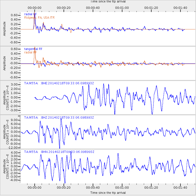
Signal To Noise
| Channel | StoN | STA | LTA |
| TA:M55A: :BHZ:20140218T09:33:06.098993Z | 7.6966643 | 3.7713894E-6 | 4.9000306E-7 |
| TA:M55A: :BHN:20140218T09:33:06.098993Z | 3.705359 | 1.5790652E-6 | 4.2615713E-7 |
| TA:M55A: :BHE:20140218T09:33:06.098993Z | 4.309462 | 1.4847128E-6 | 3.4452395E-7 |
| Arrivals |
| Ps | 1.1 SECOND |
| PpPs | 3.9 SECOND |
| PsPs/PpSs | 5.0 SECOND |


