You are here: Home > Network List > US - United States National Seismic Network Stations List
> Station AMTX Amarillo, Texas, USA > Earthquake Result Viewer
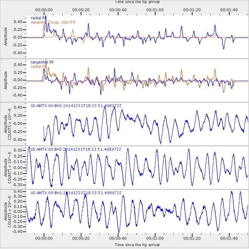
AMTX Amarillo, Texas, USA - Earthquake Result Viewer
*The percent match for this event was below the threshold and hence no stack was calculated.
| Earthquake location: |
Kermadec Islands Region |
| Earthquake latitude/longitude: |
-27.6/-177.1 |
| Earthquake time(UTC): |
2014/12/31 (365) 18:11:10 GMT |
| Earthquake Depth: |
75 km |
| Earthquake Magnitude: |
4.8 mb |
| Earthquake Catalog/Contributor: |
ISC/ISC |
|
| Network: |
US United States National Seismic Network |
| Station: |
AMTX Amarillo, Texas, USA |
| Lat/Lon: |
34.53 N/101.41 W |
| Elevation: |
1010 m |
|
| Distance: |
94.5 deg |
| Az: |
53.376 deg |
| Baz: |
239.614 deg |
| Ray Param: |
$rayparam |
*The percent match for this event was below the threshold and hence was not used in the summary stack. |
|
| Radial Match: |
41.829178 % |
| Radial Bump: |
400 |
| Transverse Match: |
62.997944 % |
| Transverse Bump: |
360 |
| SOD ConfigId: |
3390531 |
| Insert Time: |
2019-04-15 21:52:26.728 +0000 |
| GWidth: |
2.5 |
| Max Bumps: |
400 |
| Tol: |
0.001 |
|
Signal To Noise
| Channel | StoN | STA | LTA |
| US:AMTX:00:BHZ:20141231T18:23:51.498972Z | 0.9078597 | 1.889586E-7 | 2.0813634E-7 |
| US:AMTX:00:BH1:20141231T18:23:51.498972Z | 1.3616756 | 1.946158E-7 | 1.4292375E-7 |
| US:AMTX:00:BH2:20141231T18:23:51.498972Z | 1.6574347 | 2.9207078E-7 | 1.7621856E-7 |
| Arrivals |
| Ps | |
| PpPs | |
| PsPs/PpSs | |


