You are here: Home > Network List > AZ - ANZA Regional Network Stations List
> Station SMER AZ.SMER > Earthquake Result Viewer
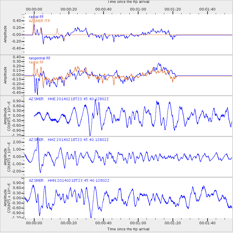
SMER AZ.SMER - Earthquake Result Viewer
*The percent match for this event was below the threshold and hence no stack was calculated.
| Earthquake location: |
Near Coast Of Peru |
| Earthquake latitude/longitude: |
-14.2/-75.6 |
| Earthquake time(UTC): |
2014/02/18 (049) 23:35:58 GMT |
| Earthquake Depth: |
57 km |
| Earthquake Magnitude: |
6.0 MWB, 5.9 MWW, 5.9 MWC, 6.0 MWC |
| Earthquake Catalog/Contributor: |
NEIC PDE/NEIC COMCAT |
|
| Network: |
AZ ANZA Regional Network |
| Station: |
SMER AZ.SMER |
| Lat/Lon: |
33.46 N/117.17 W |
| Elevation: |
355 m |
|
| Distance: |
61.8 deg |
| Az: |
320.973 deg |
| Baz: |
133.061 deg |
| Ray Param: |
$rayparam |
*The percent match for this event was below the threshold and hence was not used in the summary stack. |
|
| Radial Match: |
64.94833 % |
| Radial Bump: |
400 |
| Transverse Match: |
76.55268 % |
| Transverse Bump: |
400 |
| SOD ConfigId: |
626651 |
| Insert Time: |
2014-04-20 19:49:21.641 +0000 |
| GWidth: |
2.5 |
| Max Bumps: |
400 |
| Tol: |
0.001 |
|
Signal To Noise
| Channel | StoN | STA | LTA |
| AZ:SMER: :HHZ:20140218T23:45:40.12802Z | 4.1740475 | 1.3527274E-6 | 3.240805E-7 |
| AZ:SMER: :HHN:20140218T23:45:40.12802Z | 2.1564138 | 5.661624E-7 | 2.625481E-7 |
| AZ:SMER: :HHE:20140218T23:45:40.12802Z | 2.6692836 | 5.9955954E-7 | 2.2461441E-7 |
| Arrivals |
| Ps | |
| PpPs | |
| PsPs/PpSs | |


